Au Sable Forks, New York
| Au Sable Forks, New York | |
|---|---|
| Hamlet and census-designated place | |
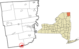
 Location in Clinton County and the state of New York. |
|
| Coordinates: 44°26′39″N 73°40′34″W / 44.44417°N 73.67611°WCoordinates: 44°26′39″N 73°40′34″W / 44.44417°N 73.67611°W | |
| Country | United States |
| State | New York |
| Counties | Clinton (CDP portion), Essex |
| Towns | Black Brook (CDP portion), Jay |
| Area | |
| • Total | 2.54 sq mi (6.58 km2) |
| • Land | 2.52 sq mi (6.53 km2) |
| • Water | 0.02 sq mi (0.06 km2) |
| Elevation | 551 ft (168 m) |
| Population (2010) | |
| • Total | 559 |
| • Density | 222/sq mi (85.7/km2) |
| Time zone | Eastern (EST) (UTC-5) |
| • Summer (DST) | EDT (UTC-4) |
| ZIP code | 12912 |
| Area code(s) | 518 Exchange: 647 |
| FIPS code | 36-03254 |
| GNIS feature ID | 0979665 |
Au Sable Forks is a hamlet in Clinton County and Essex County, New York, United States. The northern half of the community, within Clinton County, is listed as the Au Sable Forks census-designated place (CDP) and had a population of 559 at the 2010 census.
Au Sable Forks is located on the border of Clinton and Essex counties at 44°26′39″N 73°40′34″W / 44.44417°N 73.67611°W (44.444063, −73.676013), centered on the point where the West Branch and the East Branch of the Au Sable River join to form the main confluence which flows into Au Sable Chasm and thence, into Lake Champlain.
According to the United States Census Bureau, the CDP portion of Au Sable Forks has a total area of 2.5 square miles (6.6 km2), of which 0.02 square miles (0.06 km2), or 0.89%, is water.
New York State Route 9N passes through the center of the community, leading 11 miles (18 km) northeast (downstream) to Keeseville and 6 miles (10 km) southwest (upstream on the East Branch) to Jay. Plattsburgh is 28 miles (45 km) to the northeast via NY-9N and Interstate 87.
...
Wikipedia
