Arhavi
| Arhavi | |
|---|---|
| District | |

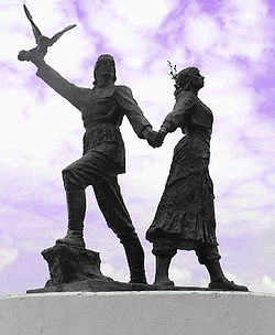
statue of local folk dancers
|
|
 Location of Artvin within Turkey. |
|
| Location of Arhavi | |
| Coordinates: 41°20′N 41°18′E / 41.333°N 41.300°E | |
| Country |
|
| Region | Black Sea |
| Province | Artvin |
| Government | |
| • Mayor | Coşkun Hekimoğlu (AKP) |
| Area | |
| • District | 299.39 km2 (115.60 sq mi) |
| Elevation | 19 m (62 ft) |
| Population (2012) | |
| • Urban | 15,973 |
| • District | 19,602 |
| • District density | 65/km2 (170/sq mi) |
| Time zone | EET (UTC+2) |
| • Summer (DST) | EEST (UTC+3) |
| Postal code | 08200 |
| Area code(s) | 466 |
| Licence plate | 08 |
| Climate | Cfa |
| Website | www.arhavi.bel.tr |
Arhavi (Laz: არქაბი/Arkabi; Georgian: არქაბი/arkabi), is a town and district of Artvin Province located in the Black Sea region of Turkey. The terrain is hilly and mountainous. Area of the city center is about 6 km2, and the total district area is 314 km2. The length of the coast is about 10 km. In 2011 with 19.362 district population the 5th biggest district population of Artvin province. With 15.622 city population, in Turkey 308th and in Artvin province after Artvin and Hopa the 3rd biggest population.Laz people generate a large portion of the population.
Arhavi is famous by the Culture and Art Festival that celebrated since 1973.
Arhavi is "Arkabi" in Laz means "Old Viçe" or "Old village" Georgian: არქაბი and was formerly known as its river "Kapisre".
Participated in the Ottoman Empire in 1486.
During the First World War, in which Turkey was an ally of Germany and Austria-Hungary, the Russian army occupied Arhavi on 14 January 1916.
Arhavi Black Sea Region is located in the eastern Black Sea. In the northern Black Sea, west of Hopa, Yusufeli border in the east and south is surrounded by hazelnut.
Is a typical Black Sea climate prevails in the district. Warm summers, cool winters have passed. In every season rainfall is common in districts with high humidity. Climate, tea, nuts, corn, and is suitable for citrus cultivation.
The people of Arhavi are mainly Laz and the district attracts visitors from neighbouring Georgia.
Arhavi's terrain is mountainous and hilly. The surface of the district forms the eastern Black Sea mountains and outlines Poplar (Kapisre) Time course of the river that connects him with deep valleys that constitute half. Districts in the region over the central plains, where the plane is no exception.
Very rugged topography of the district and the supply structure is defective in a particular period and it says connecting Şahinkaya Poplar, agar, Fish, and Lome says Çifteköprü and erode the land is deeply split. Therefore, roughly 2,000 feet (610 m) from the area between the flat coastal plain with no backup is not found immediately. Poplar Box and connect to it says the deep valleys that have opened branches in the district but also the most important transportation creates güzergahlarini.
...
Wikipedia

