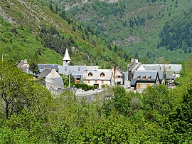
Aragnouet
| Aragnouet | ||
|---|---|---|

The village of Aragnouet
|
||
|
||
| Coordinates: 42°47′24″N 0°14′13″E / 42.79°N 0.2369°ECoordinates: 42°47′24″N 0°14′13″E / 42.79°N 0.2369°E | ||
| Country | France | |
| Region | Occitanie | |
| Department | Hautes-Pyrénées | |
| Arrondissement | Bagnères-de-Bigorre | |
| Canton | Vielle-Aure | |
| Government | ||
| • Mayor (2008–2014) | Jean Mounic | |
| Area1 | 108.29 km2 (41.81 sq mi) | |
| Population (2009)2 | 244 | |
| • Density | 2.3/km2 (5.8/sq mi) | |
| Time zone | CET (UTC+1) | |
| • Summer (DST) | CEST (UTC+2) | |
| INSEE/Postal code | 65017 / 65170 | |
| Elevation | 956–3,194 m (3,136–10,479 ft) (avg. 1,100 m or 3,600 ft) |
|
|
1 French Land Register data, which excludes lakes, ponds, glaciers > 1 km² (0.386 sq mi or 247 acres) and river estuaries. 2Population without double counting: residents of multiple communes (e.g., students and military personnel) only counted once. |
||
1 French Land Register data, which excludes lakes, ponds, glaciers > 1 km² (0.386 sq mi or 247 acres) and river estuaries.
Aragnouet is a commune in the Hautes-Pyrénées department in southwestern France.
The Bielsa tunnel under the Pyrenees connects Aragnouet and Bielsa in Spain. It was first opened in 1976. In 2002, the French government unilaterally decided to close the tunnel to heavy-goods vehicles over 3.5 tonnes, a decision which caused serious concern in Aragon.
...
Wikipedia


