Antrea
| Kamennogorsk (English) Каменногорск (Russian) |
|
|---|---|
| - Town - | |
 Panorama of Kamennogorsk across the Vuoksa River |
|
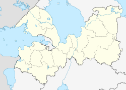
 Location of Leningrad Oblast in Russia |
|
|
|
|
|
|
|
|
|
|
| Administrative status (as of June 2013) | |
| Country | Russia |
| Federal subject | Leningrad Oblast |
| Administrative district | Vyborgsky District |
| Settlement municipal formation | Kamennogorskoye Settlement Municipal Formation |
| Administrative center of | Kamennogorskoye Settlement Municipal Formation |
| Municipal status (as of June 2013) | |
| Municipal district | Vyborgsky Municipal District |
| Urban settlement | Kamennogorskoye Urban Settlement |
| Administrative center of | Kamennogorskoye Urban Settlement |
| Statistics | |
| Population (2010 Census) | 6,739 inhabitants |
| Time zone | MSK (UTC+03:00) |
| Town status since | 1940 |
| Previous names | Antrea (until October 1, 1948) |
| Postal code(s) | 188950 |
|
|
|
| on | |
Kamennogorsk (Russian: Каменного́рск), known under the Finnish name of Antrea (Russian: А́нтреа; Swedish: S:t Andree) before 1948, is a town in Vyborgsky District of Leningrad Oblast, Russia, located on the Karelian Isthmus on the left bank of the Vuoksa River (Lake Ladoga's basin) 170 kilometers (110 mi) northwest of St. Petersburg. Population: 6,739 (2010 Census);6,084 (2002 Census);5,694 (1989 Census).
Human habitation in the area where Kamennogorsk now stands goes back to the Stone Age. In the beginning of the 20th century, a Stone Age site was discovered under a layer of peat. Findings at the site included wooden and flint implements, polished instruments of shale, remains of net of nettle fibers, sixteen fishing floats of piny bark, thirty-one stone plummets, a long bone dagger, and remains of nets with a length of 27 meters (89 ft) and a width of up to 3 meters (9.8 ft).
In the 14th-17th centuries, Antrea was a main administrative center of Karelian settlements on the upper Vuoksi. The name comes from Lutheran community founded in the 17th century and the church of St. Andrew.
In 1710, during the Great Northern War, the troops of Tsar Peter the Great included the whole area of the modern Vyborgsky District to Russia. In the course of Peter's second administrative reform, Antrea became a part of Vyborg Province of St. Petersburg Governorate. The 1721 Treaty of Nystad, which concluded the war with Sweden, finalized the transfer of this part of Old Finland to Russia.
...
Wikipedia


