Ancient Ostra

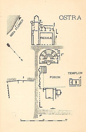
Map of Ancient Ostra, drawn up during the excavations of 1903-1904 made by Cav. Baldoni.
|
|
| Location | Ostra Vetere, Province of Ancona, Marche, Italy |
|---|---|
| Coordinates | 43°35′5″N 13°5′10″E / 43.58472°N 13.08611°ECoordinates: 43°35′5″N 13°5′10″E / 43.58472°N 13.08611°E |
| Type | Settlement |
| History | |
| Founded | 3rd century BC |
| Abandoned | 6th century |
| Periods | Roman Republic - Byzantine Empire |
| Cultures | Ancient Rome |
| Site notes | |
| Website | Sito Archeologico di Ostra (Italian) |
Ancient Ostra was situated between the modern town of Ostra Vetere and was inhabited from the 3rd century BC until the 6th century AD.
Pliny the Elder mentions Ostra with another ancient town, Suasa, 8 kilometres (5 mi) west. Neither town survived beyond the classical period. Though Ostra is little mentioned by ancient authors, excavations there have brought to light remains of various buildings and several inscriptions.
...
Wikipedia

