Amargosa River
| Amargosa River | |
|
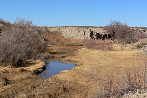
Amargosa River at Tecopa, California
|
|
| Name origin: Spanish word for "bitter" | |
| Country | United States |
|---|---|
| States | Nevada, California |
| County | Nye, San Bernardino, and Inyo |
| Source | Pahute Mesa |
| - location | Oasis Valley, Nye County, Nevada |
| - elevation | 3,964 ft (1,208 m) |
| - coordinates | 37°04′20″N 116°41′19″W / 37.07222°N 116.68861°W |
| Mouth | Death Valley |
| - location | Badwater Basin, Inyo County, California |
| - elevation | −279 ft (−85 m) |
| - coordinates | 36°14′37″N 116°51′24″W / 36.24361°N 116.85667°WCoordinates: 36°14′37″N 116°51′24″W / 36.24361°N 116.85667°W |
| Length | 185 mi (298 km) |
| Basin | 5,500 sq mi (14,245 km2) |
| Discharge | for 0.2 miles (0.3 km) west of Tecopa |
| - average | 3.8 cu ft/s (0.1 m3/s) |
| - max | 10,600 cu ft/s (300.2 m3/s) |
| - min | 0 cu ft/s (0.0 m3/s) |
|
Course map
|
|
The Amargosa River is an intermittent waterway, 185 miles (298 km) long, in southern Nevada and eastern California in the United States. It drains a high desert region, the Amargosa Valley in the Amargosa Desert northwest of Las Vegas, into the Mojave Desert, and finally into Death Valley where it disappears into the ground aquifer. Except for a small portion of its route in the Amargosa Canyon in California and a small portion at Beatty, Nevada, the river flows above ground only after a rare rainstorm washes the region. A 26-mile (42 km) stretch of the river between Shoshone and Dumont Dunes is protected as a National Wild and Scenic River. At the south end of Tecopa Valley the Amargosa River Natural Area protects the habitat.
Except during flash floods that occur after cloudbursts, most of the course of the Amargosa River is dry on the surface. The flow is generally underground except for stretches near Beatty and near Tecopa, California, in the Amargosa Canyon. In the canyon, the river passes through the Amargosa River Natural Area, a region of dense greenery and prolific wildlife made possible by the presence of water.
The river arises at about 1,200 feet (370 m) above sea level in Nye County, Nevada, along the southern side of Pahute Mesa in the Nellis Air Force Range. Thirsty Canyon Wash enters at the river's source, and when carrying water, the river flows from there southwest into Oasis Valley. Running parallel to U.S. Route 95 near the Bullfrog Hills to the west (), the river receives Sober-Up Gulch from the right and then Beatty Wash from the .
...
Wikipedia


