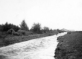
Alamo Canal
| Alamo Canal | |
|---|---|

Original caption: View on Main Canal -- Note High Velocity
|
|
| Specifications | |
| Maximum height above sea level | 125 ft (38 m) |
| Status | Closed/partially infilled |
| History | |
| Former names | Imperial |
| Original owner | California Development Company |
| Principal engineer | Charles R. Rockwood |
| Other engineer(s) | George Chaffey |
| Construction began | April 3, 1900 |
| Date of first use | May 14, 1901 |
| Date closed | 1942 |
| Geography | |
| Start point | Near Pilot Knob 32°44′24″N 114°42′39″W / 32.740137°N 114.710795°W, Imperial County, California, USA |
| End point | Head of Alamo River 32°38′31″N 114°51′21″W / 32.642064°N 114.855938°W, Mexicali Municipality, Baja California, Mexico |
| Connects to | Alamo River |
The Alamo Canal (Spanish: Canal del Álamo) was a 14 mi (23 km) long waterway that connected the Colorado River to the head of the Alamo River. The canal was constructed to provide irrigation to the Imperial Valley. A small portion of the canal was located in the United States but the majority of the canal was located in Mexico. The Alamo Canal is also known as the Imperial Canal.
Historically, the Colorado River flowed to the Gulf of California, however in times of the spring floods the Colorado River would overflow its banks and also drain into the Alamo River. Flow from the Alamo River then drained to the Salton Sink area of the Colorado Desert. Such overflow had been observed in 1884, 1891, 1892, and 1895.
In the mid- to late-Nineteenth Century several individuals, most notably O. M. Wozencraft, proposed irrigating the Salton Sink by diverting a controlled gravity-fed flow of the Colorado River through the existing dry Alamo River bed. The Alamo Canal was the first attempt to create that diversion. It was engineered by George Chaffey of the California Development Company starting in 1900.
The canal intake and temporary wooden headgates (known as the Chaffey Gate) were initially located in the United States at Pilot Knob due to the availability of a solid rock foundation. The canal then crossed the border with Mexico and ran parallel to the Colorado River for approximately 4 miles (6 km), where a channel was cut several miles west to the head of the Alamo River. This path was selected to avoid the expensive engineering that would otherwise be required if the canal were to traverse the Algodones Dunes.
A small amount of irrigation water was first delivered to the Imperial Valley in 1901, with larger flows becoming available in 1902.
...
Wikipedia
