Afrikanda (rural locality)
| Afrikanda (in English) Африканда (Russian) |
|
|---|---|
| - Rural locality - Inhabited locality |
|
 Residential apartment blocks in Afrikanda |
|
 Location of Murmansk Oblast in Russia |
|
|
|
|
|
|
|
| Administrative status (as of 2011) | |
| Country | Russia |
| Federal subject | Murmansk Oblast |
| Administratively subordinated to | Polyarnye Zori Town with Jurisdictional Territory |
| Municipal status (as of October 2007) | |
| Urban okrug | Polyarnye Zori Urban Okrug |
| Statistics | |
| Population (2010 Census) | 1,644 inhabitants |
| Time zone | MSK (UTC+03:00) |
| Postal code(s) | 184220 |
| Dialing code(s) | +7 81532 |
| on | |
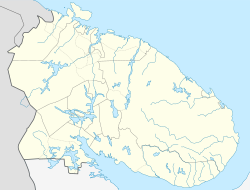
Afrikanda (Russian: Африканда) is a rural locality (an inhabited locality) in administrative jurisdiction of Polyarnye Zori Town with Jurisdictional Territory in Murmansk Oblast, Russia, located beyond the Arctic Circle on the Kola Peninsula at a height of 140 meters (460 ft) above sea level. Population: 1,644 (2010 Census).
Afrikanda used to be classified as an urban-type settlement but was demoted in status to that of a rural locality on January 1, 2005.
Afrikanda is served by a minor railway station of the same name on the Kirov Railway, between Polyarnye Zori and Apatity.
An air base of the same name is located just north of Afrikanda.
...
Wikipedia

