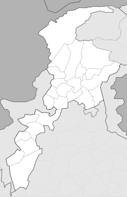
Abottabad
|
Abbottabad (Urdu: ایبٹ آباد) |
|
|---|---|
| Abbottabad | |

View of Abbottabad from Shimla Hill
|
|
| Coordinates: 34°9′21″N 73°13′10″E / 34.15583°N 73.21944°ECoordinates: 34°9′21″N 73°13′10″E / 34.15583°N 73.21944°E | |
| Country |
|
| Province |
|
| District | Abbottabad |
| Founded | 1863 |
| Elevation | 1,256 m (4,121 ft) |
| Population | |
| • Total | 1,430,238 |
| Time zone | PST (UTC+5) |
| Calling code | 0992 |
| HDI | 0.70 |
| HDI Category | High |
| Number of Union Councils | 6 |
| Website | http://www.abottabad.gov.pk |
| Abbottabad District Government | |
Abbottabad (/ˈæbətəbæd/ or /ˈɑːbtəbæd/) (Urdu, Hindko: ایبٹ آباد Aibṭ ābād [ɛːbʈaːˈbaːd̪]) is a city located in the Hazara region of Khyber Pakhtunkhwa province, in northeastern Pakistan. The city is situated in 110 kilometres (68 mi) north of the capital Islamabad, 130 kilometres (81 mi) from Rawalpindi and 150 kilometres (93 mi) northeast of Peshawar at an altitude of 1,260 metres (4,134 ft) and is the capital of the Abbottabad District. Kashmir lies to the east of the city.
...
Wikipedia


