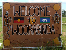
Aboriginal Shire of Woorabinda
|
Woorabinda Queensland |
|
|---|---|
 |
|
| Coordinates | 24°7′S 149°27′E / 24.117°S 149.450°ECoordinates: 24°7′S 149°27′E / 24.117°S 149.450°E |
| Population | 1,033 (2011 census) |
| • Density | 2.642/km2 (6.843/sq mi) |
| Established | 1927 |
| Postcode(s) | 4713 |
| Area | 391 km2 (151.0 sq mi) |
| LGA(s) | Woorabinda Aboriginal Shire Council |
| State electorate(s) | Gregory |
| Federal Division(s) | Flynn |
Woorabinda /ˈwʊərəbɪndə/ is an Aboriginal community in Central Queensland, Australia, inland about two hours' west drive of Rockhampton. At the 2006 census, Woorabinda had a population of 851.
Woorabinda was first established in 1927, with land gazetted from the County of Waroona, as a replacement for the Taroom Aboriginal Settlement. The land at Taroom was repossessed for the development of proposed Nathan Dam for the Dawson River Irrigation Scheme, which was ultimately never built.
Central Queensland had a high level of frontier violence and Aboriginal deaths, such as at Cullin-La-Ringo at nearby Springsure and Hornet Bank along the Dawson River. There was a forcible relocation of dispossessed survivors into government-controlled settlements starting from 1897, with the introduction of the Aboriginals Protection Act—initially at Taroom, and then Woorabinda. Peoples from at least 17 different language groups were placed within the camp, some from as far as Mornington Island, and were under the control of a local Superintendent beneath the state Chief Protector of Aborigines.
...
Wikipedia

