A442 road
| A442 | |
|---|---|

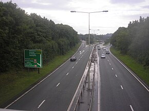
The A442 passing through Telford as Queensway.
|
|
| Route information | |
| Length: | 56.2 mi (90.4 km) |
| Major junctions | |
| South end: | Droitwich |
|
|
|
| North end: | Hodnet |
| Location | |
|
Primary destinations: |
Kidderminster Bridgnorth Telford |
| Road network | |
The A442 is a main road which passes through the counties of Worcestershire and Shropshire, in the West Midlands region of England.
From Droitwich in Worcestershire it runs towards Kidderminster where it meets the A449 from Worcester. This section of road used to be the B4192 until the late 1970s when it was upgraded to A road status.
At Kidderminster, it starts again and then runs north-north-west into Shropshire, via Bridgnorth and Telford (where it crosses the M54 motorway). Through Telford it is known as Queensway, and the Eastern Primary (EP). It ends where it meets the A53 just outside the village of Hodnet. Before the A53 bypass around the village was built, the A442 continued through Hodnet and joined the A41 near Darliston, south of Whitchurch. This section of road however has now been downgraded: most of it is declassified, but part has been reclassified as part of B5065. However Googlemaps.com is currently still mistakenly listing the now declassified route as still being the A442.
From Droitwich to Low Hill (south of Kidderminster) the road is probably ancient, as it is referred to in the Saxon charter for Whitlinge (in Hartlebury) dated AD 980 as a stræte. This road was maintained by a Droitwich turnpike trust eatablished in 1755.
...
Wikipedia

