A449 road
| A449 | |
|---|---|
 |
|
 |
|
| Route information | |
| Maintained by Highways England, English local authorities and South Wales Trunk Road Agency | |
| Length: | 104 mi (167 km) |
| Major junctions | |
| North end: | Stafford |
|
|
|
| South end: | Newport |
| Location | |
|
Primary destinations: |
Wolverhampton Kidderminster Worcester Ross-on-Wye |
| Road network | |
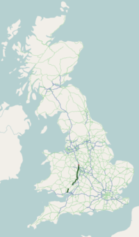
The A449 is a major road in the United Kingdom. It runs north from junction 24 of the M4 motorway at Newport in South Wales to Stafford in Staffordshire.
The southern section of the road, between Ross on Wye and Newport forms part of the trunk route from the English Midlands to South Wales, avoiding the Severn Bridge
The A449 starts on the M4 at the Coldra Interchange (J24) in Newport and is dual carriageway all the way to Raglan. The section from the A40 junction at Raglan to the A472 junction at Usk, known as the New Midlands Road, was one of the first sections to be dualled, opening on 16 October 1970. Between Raglan and Ross-on-Wye the A449 is concurrent with the A40.
The road becomes quite twisty on departing Ross-on-Wye, but straightens out a little before arriving at Ledbury. The road turns northwards upon crossing into Worcestershire at Little Malvern and skirts the eastern slopes of the Malvern Hills through the town of Great Malvern. It then crosses Worcester's ring road, the A4440, at a roundabout near Powick.
...
Wikipedia

