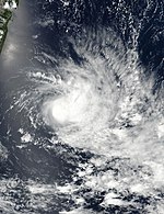
2016–17 South-West Indian Ocean cyclone season
| 2016–17 South-West Indian Ocean cyclone season | |
|---|---|

Season summary map
|
|
| Seasonal boundaries | |
| First system formed | July 15, 2016 |
| Last system dissipated | Season ongoing |
| Strongest storm | |
| Name | Enawo |
| • Maximum winds | 205 km/h (125 mph) (10-minute sustained) |
| • Lowest pressure | 925 hPa (mbar) |
| Seasonal statistics | |
| Total disturbances | 7 |
| Total depressions | 7 |
| Total storms | 5 |
| Tropical cyclones | 3 |
| Intense tropical cyclones | 1 |
| Total fatalities | 88 total |
| Total damage | $16.5 million (2017 USD) |
| Related articles | |
| Severe tropical storm (MFR) | |
| Tropical storm (SSHWS) | |
| Duration | July 15 – July 20 |
|---|---|
| Peak intensity | 95 km/h (60 mph) (10-min) 987 hPa (mbar) |
| Subtropical depression (MFR) | |
| Duration | October 2 – October 6 |
|---|---|
| Peak intensity | 95 km/h (60 mph) (10-min) 988 hPa (mbar) |
| Tropical depression (MFR) | |
| Duration | January 27 – January 28 |
|---|---|
| Peak intensity | 55 km/h (35 mph) (10-min) 1006 hPa (mbar) |
| Tropical cyclone (MFR) | |
| Category 1 tropical cyclone (SSHWS) | |
| Duration | February 2 – February 10 |
|---|---|
| Peak intensity | 120 km/h (75 mph) (10-min) 975 hPa (mbar) |
| Tropical cyclone (MFR) | |
| Category 1 tropical cyclone (SSHWS) | |
| Duration | February 13 – February 17 |
|---|---|
| Peak intensity | 140 km/h (85 mph) (10-min) 955 hPa (mbar) |
| Intense tropical cyclone (MFR) | |
| Category 4 tropical cyclone (SSHWS) | |
| Duration | March 2 – March 9 |
|---|---|
| Peak intensity | 205 km/h (125 mph) (10-min) 925 hPa (mbar) |
| Moderate tropical storm (MFR) | |
| Tropical storm (SSHWS) | |
| Duration | March 6 – March 14 |
|---|---|
| Peak intensity | 65 km/h (40 mph) (10-min) 992 hPa (mbar) |
The 2016–17 South-West Indian Ocean cyclone season is a current event of the annual cycle of tropical cyclone and subtropical cyclone formation. It began on November 15, 2016, and will end on April 30, 2017, with the exception for Mauritius and the Seychelles, for which it will end on May 15, 2017. These dates conventionally delimit the period of each year when most tropical and subtropical cyclones form in the basin, which is west of 90°E and south of the Equator. Tropical and subtropical cyclones in this basin are monitored by the Regional Specialised Meteorological Centre in Réunion.
On November 4, the Mauritius Meteorological Services (MMS) released their summer 2016–17 outlook. It is expected that six to eight cyclones will form in the Southwest Indian Ocean throughout the season from November through the first half of May. This is in addition to the two cyclones, Abela and Bransby, that formed before the outlook period. MMS also indicated that the region south of Diego Garcia would be a center of focus for cyclone formation.
On July 15, a tropical depression formed to the southwest of Diego Garcia. This marked only the fourth occurrence of a tropical cyclone existing in the southwest Indian Ocean during the month of July, with the others being Moderate Tropical Storm Odette in 1971, Tropical Depression M2 in 1997 and Tropical Cyclone 01U in July 2007. The next day, the depression acquired moderate tropical storm status as gale-force winds extended more than halfway around the center. The system tracked west-southwest, organizing slowly in the face of moderate vertical wind shear. On the evening of July 17, RSMC La Réunion initiated warnings on the storm after a scatterometer pass revealed 75 km/h (45 mph) winds. At the same time, Mauritius Meteorological Services named the storm Abela. The small system briefly attained severe tropical storm strength the next day as a low-level eye developed. Abela began to weaken quickly in the subsequent hours as it moved into a region with cool sea surface temperatures and low oceanic potential. Abela became a remnant low on July 20 as it neared the coast of Madagascar.
...
Wikipedia


