2010 Mentawai earthquake and tsunami
 |
|
| Date | October 25, 2010 |
|---|---|
| Origin time | 14:42:22 UTC |
| Magnitude | 7.7 Mw |
| Depth | 12.8 miles (20.6 km) |
| Epicenter | 3°27′50″S 100°05′02″E / 3.464°S 100.084°ECoordinates: 3°27′50″S 100°05′02″E / 3.464°S 100.084°E |
| Areas affected |
Indonesia Malaysia |
| Casualties | 408 dead + 303 missing |
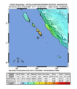
The 2010 Mentawai earthquake occurred with a moment magnitude of 7.7 on 25 October off the western coast of Sumatra at 21:42 local time (14:42 UTC). The earthquake occurred on the same fault that produced the 2004 Indian Ocean earthquake. It was widely felt across the provinces of Bengkulu and West Sumatra and resulted in a substantial localized tsunami that struck the Mentawai Islands.
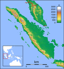
The island of Sumatra lies above the Sunda megathrust, the interface between the subducting Australian Plate and the overriding Sunda Plate. Movement on this structure has been responsible for many large historical megathrust earthquakes. The most recent sequence of large ruptures started with the 2004 Indian Ocean earthquake and included the 2005 Nias–Simeulue earthquake and the .
The earthquake occurred around 150 miles (240 km) west of Bengkulu, close to the Mentawai Islands, southwest of South Pagai. The USGS first reported the hypocenter of the quake at 20.5 miles (33.0 km) deep, but later changed it to 8.8 miles (14.2 km) deep and then 12.8 miles (20.6 km). The USGS also estimated the magnitude at 7.5 before revising the measurement to 7.7. The intensity was MM IV in Bengkulu and MM III in Padang.
The October 2010 earthquake is thought to have been a result of thrust faulting along or near the plate interface from the calculated focal mechanism and the focal depth. According to seismic hazard potentials and deformation features, the Sunda Trench can be divided into several segments. The southern segment lies to the south of Siberut Island. The rupture area of this earthquake is situated within the southern segment, where historical earthquakes include the earthquake of 1797 and the Mw ~ 9.0 1833 Sumatra earthquake.
...
Wikipedia

