Bengkulu
| Bengkulu | |||||||
|---|---|---|---|---|---|---|---|
| Province | |||||||
Bengkulu montage:
Bengkulu Governor Office at Bengkulu City Enggano Island Curup Public Square & Grand Mosque of Curup Tes Lake Lebong Regency, Bengkulu |
|||||||
|
|||||||
| Nickname(s): Bumi Rafflesia | |||||||
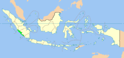
 Location of Bengkulu (marked in light green) in Indonesia |
|||||||
 Map of Bengkulu |
|||||||
| Coordinates: 3°48′S 102°15′E / 3.800°S 102.250°ECoordinates: 3°48′S 102°15′E / 3.800°S 102.250°E | |||||||
| Country |
|
||||||
| Capital and Largest City |
|
||||||
| Government | |||||||
| • Governor | Dr. H. Ridwan Mukti, M.H | ||||||
| • Vice Governor | Dr. H. Rohidin Mersyah, M.M | ||||||
| Area | |||||||
| • Total | 19,919.33 km2 (7,690.90 sq mi) | ||||||
| Population (2014 Estimate) | |||||||
| • Total | 1,828,291 | ||||||
| • Density | 92/km2 (240/sq mi) | ||||||
| Demographics | |||||||
| • Ethnic groups | Rejang (60,4%), Javanese (22,3%), Serawai (17,9%), Lembak (4,9%), Pasemah (4,4%), Minangkabau (4,3%), Malay (3,6%), Sundanese (3%), Batak (2%) | ||||||
| • Religion | Islam 95,27%, Christianity 3,59%, Hindu 0,73%, Buddhism 0,41% | ||||||
| • Languages | Indonesian (official language), Rejangese, Javanese language, Serawai, Lembak language, etc. | ||||||
| Time zone | WIB (UTC+7) | ||||||
| Area code(s) | 0732 (Kepahiang, Curup or Rejang Lebong), 0736 (Bengkulu, Central Bengkulu, Seluma), 0737 (Muko-Muko, North Bengkulu), 0738 (Lebong), 0739 (Kaur, South Bengkulu) | ||||||
| Vehicle registration | BD | ||||||
| HDI |
|
||||||
| HDI rank | 11th (2013) | ||||||
| Website | www |
||||||
Bengkulu, historically known as Bencoolen or British Bencoolen, is one of the Provinces of Indonesia and is located in the southwest coast of Sumatra. It was formed on 18 November 1968 by separating out the former Bengkulu Residency area from South Sumatra (Sumatra Selatan) province under Law No. 9 of 1967 and was realized by Government Regulation No. 20 of 1968. Spread over 19,813 km2, it is bordered by the provinces of West Sumatra (Sumatra Barat) to the north, Jambi to the northeast, Lampung to the southeast, South Sumatra (Sumatra Selatan) to the east, and the India Ocean to the northwest, south, southwest, and west.
Bengkulu is the 25th largest province by area; it is divided into nine regencies and the separate city of Bengkulu, the capital and largest city. Bengkulu is also the 26th largest province by population in Indonesia. According to a release by Badan Pusat Statistik, it has the eleventh highest Human Development Index among the provinces, with a score about 0.744 in 2013. By 2014, the province positions 28th highest in gross domestic product and 20th highest in life expectancy, 70.35 years.
Bengkulu Province comprises not only land on southwest Sumatra, but also includes Mega Island and Enggano Island in the Indian Ocean. Bengkulu has 525 kilometres of coastline along the Indian Ocean on its western side, from Dusun Baru Pelokan in Muko-Muko Regency to Tebing Nasal in Kaur Regency. Bengkulu is home to many natural resources such as coal and gold, and has big and potential geothermal resources. In addition, it is less developed than other provinces in Sumatra.
Geographically, Bengkulu is located between 2° and 5° South Latitude and between 101° and 104° Eastern Longitude. The north–south-trending Bengkulu Mountains, which are surmounted by both active and extinct volcanoes, run parallel to the coast and traverse the length of the province. Bukit Barisan mountain range constitutes its northeastern border, beyond which laid of South Sumatra province and Jambi province. The province protected by a stretch of mountains, which soon flow into the mighty Bukit Barisan. Tigers and elephants wander through the remains of the original rainforest, where exotic rafflesia's and orchids grow.
...
Wikipedia


