2005 Nias–Simeulue earthquake

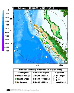
Epicentre map from NOAA
|
|
| Date | 28 March 2005 |
|---|---|
| Origin time | 14:09:37 UTC |
| Magnitude | 8.6 Mw |
| Depth | 30 km (19 mi) |
| Epicenter | 2°05′N 97°09′E / 2.09°N 97.15°ECoordinates: 2°05′N 97°09′E / 2.09°N 97.15°E |
| Areas affected | Indonesia |
| Max. intensity | VIII (Severe) |
| Casualties | 915–1,314 deaths 340–1,146 injured |
The 2005 Nias–Simeulue earthquake occurred on 28 March off the west coast of northern Sumatra, Indonesia. At least 915 people were killed, mostly on the island of Nias. The event caused panic in the region, which had been devastated by the massive tsunami triggered by the 2004 Indian Ocean earthquake, but this earthquake generated a relatively small tsunami that caused limited damage. It was the third most powerful earthquake since 1965 in Indonesia.
The earthquake occurred at 16:09:37 UTC (23:09:37 local time) on 28 March 2005. The hypocenter was located 30 kilometres (19 mi) below the surface of the Indian Ocean, where subduction is forcing the Indo-Australian Plate to the southwest under the Eurasian Plate's Sunda edge. The area is 200 kilometres (120 mi) west of Sibolga, Sumatra, or 1,400 kilometres (870 mi) northwest of Jakarta, approximately halfway between the islands of Nias and Simeulue. Seismic recordings give the earthquake a moment magnitude of about 8.6, and effects were felt as far away as Bangkok, Thailand, over 1,000 kilometres (620 mi) away.
The earthquake lasted for about two minutes. In the twenty-four hours immediately after the event, there were eight major aftershocks, measuring between 5.5 and 6.0. Despite the proximity of the epicenter to that for the 2004 Indian Ocean earthquake, it ruptured a separate segment of the Sunda megathrust and was most likely triggered by stress changes associated with that earlier event.
...
Wikipedia
