1994–95 South-West Indian Ocean cyclone season
| 1994–95 South-West Indian Ocean cyclone season |

Season summary map
|
| Seasonal boundaries |
| First system formed |
October 2, 1994 |
| Last system dissipated |
April 11, 1995 |
| Strongest storm |
|
| Name |
Marlene |
| • Maximum winds |
185 km/h (115 mph)
(10-minute sustained) |
| • Lowest pressure |
920 hPa (mbar) |
| Seasonal statistics |
| Total disturbances |
20 |
| Total depressions |
13 |
| Total storms |
11 |
| Tropical cyclones |
5 |
| Intense tropical cyclones |
3 |
| Total fatalities |
None reported |
| Total damage |
Unknown |
| Related articles |
|
|
South-West Indian Ocean tropical cyclone seasons
1992–93, 1993–94, 1994–95, 1995–96, 1996–97
|
| Intense tropical cyclone (MFR) |
| Category 4 tropical cyclone (SSHWS) |
|
|
| Duration |
November 23 – December 3 |
| Peak intensity |
175 km/h (110 mph) (10-min) 925 hPa (mbar) |
| Moderate tropical storm (MFR) |
| Tropical storm (SSHWS) |
|
|
| Duration |
December 27 – January 11 |
| Peak intensity |
85 km/h (50 mph) (10-min) 980 hPa (mbar) |
| Moderate tropical storm (MFR) |
| Tropical storm (SSHWS) |
|
|
| Duration |
January 2 – January 6 |
| Peak intensity |
85 km/h (50 mph) (10-min) 984 hPa (mbar) |
| Intense tropical cyclone (MFR) |
| Category 3 tropical cyclone (SSHWS) |
|
|
| Duration |
January 18 – February 1 |
| Peak intensity |
175 km/h (110 mph) (10-min) 925 hPa (mbar) |
| Severe tropical storm (MFR) |
| Tropical storm (SSHWS) |
|
|
| Duration |
January 22 – January 28 |
| Peak intensity |
100 km/h (65 mph) (10-min) 970 hPa (mbar) |
| Tropical cyclone (MFR) |
| Category 1 tropical cyclone (SSHWS) |
|
|
| Duration |
January 31 – February 11 |
| Peak intensity |
120 km/h (75 mph) (10-min) 970 hPa (mbar) |
| Moderate tropical storm (MFR) |
| Tropical storm (SSHWS) |
|
|
| Duration |
February 4 (entered basin) – February 8 |
| Peak intensity |
75 km/h (45 mph) (10-min) 990 hPa (mbar) |
| Tropical cyclone (MFR) |
| Category 3 tropical cyclone (SSHWS) |
|
|
| Duration |
February 22 – March 3 |
| Peak intensity |
150 km/h (90 mph) (10-min) 945 hPa (mbar) |
| Severe tropical storm (MFR) |
| Category 1 tropical cyclone (SSHWS) |
|
|
| Duration |
March 5 – March 12 |
| Peak intensity |
105 km/h (65 mph) (10-min) 972 hPa (mbar) |
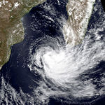
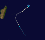
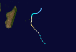
The 1994–95 South-West Indian Ocean cyclone season was fairly active, with storms forming regularly from October through April. It was much less damaging than its predecessor, and most of the storms in the season remained over water or only brushed land. The first system was Tropical Depression A1, which formed in October and passed north of Madagascar. The first named storm was Albertine, which formed on November 23 in the northeastern portion of the basin and became one of three intense tropical cyclones. The last storm was Marlene, which was also an intense tropical cyclone and dissipated on April 11.
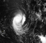
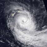
Most of the storms originated from the intertropical convergence zone. In late December into early January, tropical storms Bentha and Christelle persisted to the east of Madagascar, undergoing the Fujiwhara effect with each other. Later in January, Dorina became the second of three intense tropical cyclones, but weakened before passing near Rodrigues. Tropical Depression Eliceca and Tropical Storm Fodah both formed in the Mozambique Channel toward the end of January, bringing gusty winds and rainfall to the region. In February, Gail produced gusty winds on Rodrigues, and Tropical Storm Heida entered the basin from Australian region. Later in the month, Ingrid brought strong winds to Mauritius. Tropical storms Josta and Kylie developed toward the beginning of March from the same overall system, affecting Madagascar and Réunion, respectively. After they dissipated, Tropical Depression Lidy caused flooding and damage on Rodrigues due to heavy rainfall.
During the year, the Météo-France office on Réunion (MFR) issued warnings for tropical systems in the region as the Regional Specialised Meteorological Centre. In the year, MFR tracked tropical cyclones south of the equator from the coast of Africa to 90° E. The Joint Typhoon Warning Center (JTWC) also issued warnings in an unofficial capacity.
...
Wikipedia


