1995–96 South-West Indian Ocean cyclone season
| 1995–96 South-West Indian Ocean cyclone season |

Season summary map
|
| Seasonal boundaries |
| First system formed |
November 19, 1995 |
| Last system dissipated |
May 4, 1996 |
| Strongest storm |
|
| Name |
Bonita |
| • Maximum winds |
185 km/h (115 mph)
(10-minute sustained) |
| • Lowest pressure |
920 hPa (mbar) |
| Seasonal statistics |
| Total depressions |
21 |
| Total storms |
10, 1 unofficial |
| Tropical cyclones |
6 |
| Intense tropical cyclones |
3 |
| Total fatalities |
109 |
| Total damage |
Unknown |
| Related articles |
|
|
South-West Indian Ocean tropical cyclone seasons
1993–94, 1994–95, 1995–96, 1996–97, 1997–98
|
| Intense tropical cyclone (MFR) |
| Category 5 tropical cyclone (SSHWS) |
|
|
| Duration |
November 19 (entered basin) – November 27 |
| Peak intensity |
175 km/h (110 mph) (10-min) 925 hPa (mbar) |
| Intense tropical cyclone (MFR) |
| Category 4 tropical cyclone (SSHWS) |
|
|
| Duration |
January 3 – January 15 |
| Peak intensity |
185 km/h (115 mph) (10-min) 920 hPa (mbar) |
| Severe tropical storm (MFR) |
| Category 1 tropical cyclone (SSHWS) |
|
|
| Duration |
January 9 (entered basin) – January 12 |
| Peak intensity |
100 km/h (65 mph) (10-min) 965 hPa (mbar) |
| Severe tropical storm (MFR) |
| Category 1 tropical cyclone (SSHWS) |
|
|
| Duration |
February 12 – February 20 |
| Peak intensity |
95 km/h (60 mph) (10-min) 977 hPa (mbar) |
| Tropical cyclone (MFR) |
| Category 2 tropical cyclone (SSHWS) |
|
|
| Duration |
February 19 – February 29 |
| Peak intensity |
150 km/h (90 mph) (10-min) 945 hPa (mbar) |
| Tropical cyclone (MFR) |
| Category 4 tropical cyclone (SSHWS) |
|
|
| Duration |
February 25 – March 6 |
| Peak intensity |
150 km/h (90 mph) (10-min) 945 hPa (mbar) |
| Moderate tropical storm (MFR) |
| Tropical storm (SSHWS) |
|
|
| Duration |
March 17 – March 25 |
| Peak intensity |
65 km/h (40 mph) (10-min) 992 hPa (mbar) |
| Tropical cyclone (MFR) |
| Category 2 tropical cyclone (SSHWS) |
|
|
| Duration |
April 2 – April 10 |
| Peak intensity |
120 km/h (75 mph) (10-min) 962 hPa (mbar) |
| Intense tropical cyclone (MFR) |
| Category 5 tropical cyclone (SSHWS) |
|
|
| Duration |
April 6 – April 19 |
| Peak intensity |
175 km/h (110 mph) (10-min) 925 hPa (mbar) |
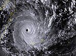
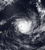
The 1995–96 South-West Indian Ocean cyclone season was a moderately active season that included Cyclone Bonita, which was the first known tropical cyclone to cross from the southern Indian Ocean into the southern Atlantic Ocean. Tropical activity lasted for about six months from the middle of November 1995 to early May 1996. The first storm, Intense Tropical Cyclone Agnielle, formed in the adjacent Australian basin on November 16 and later reached peak winds in the south-west Indian Ocean. The next named storm after Agnielle was Bonita, which formed in early January and killed 42 people. The basin was most active in February, with two tropical cyclones, or the equivalent of a minimal hurricane, as well as a severe tropical storm. The first of these three was Doloresse, which killed 67 people due to a shipwreck in the Comoros. The next storm was Cyclone Edwige, which caused heavy crop damage on Mauritius before looping along the east coast of Madagascar. In March, both Cyclone Flossy and Tropical Storm Guylianne passed near the Mascarene Islands, producing heavy rainfall and gusty winds.
Tropical activity continued through April and May, with two tropical cyclones in the former month. In early April, Tropical Cyclone Hansella moved over the island of Rodrigues, dropping more rainfall in 24 hours than the average monthly total. Later, Itelle became a rare April intense tropical cyclone, but weakened before it approached St. Brandon island. The final storm of the season, Jenna, formed in the Australian region, briefly intensified into a minimal tropical storm in the south-west Indian Ocean, and proceeded to exit the basin on May 4 to end the season. In addition to the named storms, several tropical depressions were tracked, one of which in December dropped heavy rainfall on Réunion.
During the season, the Météo-France office (MFR) on Réunion island issued warnings in tropical cyclones within the basin. The agency estimated intensity through the Dvorak technique, and warned on tropical cyclones in the region from the coast of Africa to 90° E, south of the equator. The Joint Typhoon Warning Center (JTWC), which is a joint United States Navy – United States Air Force task force, also issued tropical cyclone warnings for the southwestern Indian Ocean.
...
Wikipedia


