1970 Ancash earthquake
 |
|
| Date | 31 May 1970 |
|---|---|
| Origin time | 15:23:29 local |
| Duration | ~ 45 seconds |
| Magnitude | 7.9 Mw |
| Depth | 45 km (28 mi) |
| Epicenter | 9°24′S 78°54′W / 9.4°S 78.9°WCoordinates: 9°24′S 78°54′W / 9.4°S 78.9°W |
| Areas affected | Peru |
| Max. intensity | VIII (Severe) |
| Peak acceleration | .1g at Lima |
| Tsunami | .38 m (1 ft 3 in) |
| Casualties | 66,794–70,000 dead 50,000 injured |
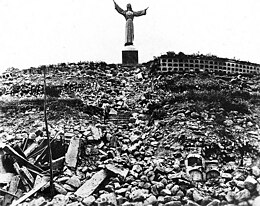
The 1970 Ancash earthquake (also known as the Great Peruvian earthquake) occurred on 31 May off the coast of Peru in the Pacific Ocean at 15:23:29 local time. Combined with a resultant landslide, it was the worst catastrophic natural disaster in the history of Peru. Due to the large amounts of snow and ice included in the landslide and its estimated 66,794 to 70,000 casualties, it is also considered to be the world's deadliest avalanche.
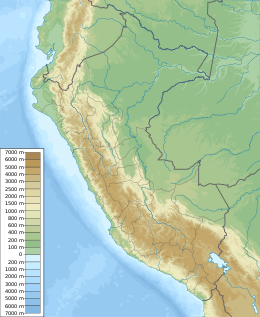
The undersea earthquake struck on a Sunday afternoon and lasted about 45 seconds. The shock affected the Peruvian regions of Ancash and La Libertad. The epicenter was located 35 km (22 mi) off the coast of Casma and Chimbote on the Pacific Ocean, where the Nazca Plate is being subducted by the South American Plate. It had a moment magnitude of 7.9 and a maximum Mercalli intensity of VIII (Severe).
The earthquake affected an area of about 83,000 km², an area larger than Belgium and the Netherlands combined, in the north central coast and the Sierra (highlands) of the Ancash Region and southern La Libertad Region. Reports of damage and casualties from Tumbes to Pisco and Iquitos in the east. Damage and panic scenes were reported in some parts of Ecuador. Tremors were felt too in western and central Brazil.
...
Wikipedia

