1961 Pacific typhoon season
| 1961 Pacific typhoon season |

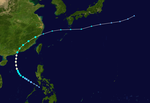
Season summary map
|
| Seasonal boundaries |
| First system formed |
January 14, 1961 |
| Last system dissipated |
December 14, 1961 |
| Strongest storm |
|
| Name |
Nancy |
| • Maximum winds |
345 km/h (215 mph) |
| • Lowest pressure |
882 hPa (mbar) |
| Seasonal statistics |
| Total depressions |
53 |
| Total storms |
35 |
| Typhoons |
20 |
| Super typhoons |
8 |
| Total fatalities |
at least 308 |
| Total damage |
Unknown |
| Related articles |
|
|
Pacific typhoon seasons
1959, 1960, 1961, 1962, 1963
|
| Tropical Storm (JMA) |
| Tropical Storm (SSHWS) |
|
|
| Duration |
January 14 – January 19 |
| Peak intensity |
75 km/h (45 mph) (1-min) 996 hPa (mbar) |
| Tropical depression (JMA) |
| Tropical Storm (SSHWS) |
|
|
| Duration |
February 27 – March 1 |
| Peak intensity |
75 km/h (45 mph) (1-min) 1006 hPa (mbar) |
| Typhoon (JMA) |
| Category 4 typhoon (SSHWS) |
|
|
| Duration |
March 22 – March 31 |
| Peak intensity |
240 km/h (150 mph) (1-min) 940 hPa (mbar) |
| Tropical depression (JMA) |
| Tropical Storm (SSHWS) |
|
|
| Duration |
April 9 – April 11 |
| Peak intensity |
95 km/h (60 mph) (1-min) 1004 hPa (mbar) |
| Typhoon (JMA) |
| Category 1 typhoon (SSHWS) |
|
|
| Duration |
May 15 – May 20 |
| Peak intensity |
140 km/h (85 mph) (1-min) 980 hPa (mbar) |
| Typhoon (JMA) |
| Category 4 typhoon (SSHWS) |
|
|
| Duration |
May 21 – May 28 |
| Peak intensity |
240 km/h (150 mph) (1-min) 945 hPa (mbar) |
| Typhoon (JMA) |
| Category 1 typhoon (SSHWS) |
|
|
| Duration |
June 21 – June 25 |
| Peak intensity |
130 km/h (80 mph) (1-min) 985 hPa (mbar) |
| Tropical Storm (JMA) |
| Tropical depression (SSHWS) |
|
|
| Duration |
June 25 – June 29 |
| Peak intensity |
75 km/h (45 mph) (1-min) 996 hPa (mbar) |
| Tropical Storm (JMA) |
| Tropical Storm (SSHWS) |
|
|
| Duration |
June 27 – July 3 |
| Peak intensity |
85 km/h (50 mph) (1-min) 990 hPa (mbar) |
The 1961 Pacific typhoon season had no official bounds; it ran year-round in 1961, but most tropical cyclones tend to form in the northwestern Pacific Ocean between June and December. These dates conventionally delimit the period of each year when most tropical cyclones form in the northwestern Pacific Ocean.
The scope of this article is limited to the Pacific Ocean, north of the equator and west of the international date line. Storms that form east of the date line and north of the equator are called hurricanes; see 1961 Pacific hurricane season. Tropical storms formed in the entire west pacific basin were assigned a name by the Joint Typhoon Warning Center. Tropical depressions in this basin had the "W" suffix added to their number.
A tropical low developed from the ITCZ about 140 miles to the south of Eauripik on January 8. The low gradually deepened as it moved west-northwest during the following days. Early on January 14 the system organized itself enough to be classified as a tropical depression. The next day the depression strengthened into a tropical storm, and was named Rita by the Joint Typhoon Warning Center. Rita reached a peak intensity of 45 mph (75 km/h) and a minimal surface pressure of 996 hPa (29.4 inHg) on January 16. At this time a cold front to the north and a subtropical ridge positioned behind it forced the storm to turn sharply to the north-northeast. Rita began to, at this time, weaken, and became a depression on January 17. It remained a depression for the next three days. On January 19 Rita weakened to a remnant low and became attached to the tail-end of a passing front. By the 21 what was left of Rita became fully absorbed by the aforementioned front.
Rita stayed largely at sea with little to minor effects to Palau or to the Mariana Islands, besides some rain and squally weather.
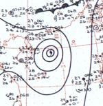
Typhoon Alice formed to the east of the Philippines on the 17th of May. Alice quickly strengthened and passed directly over Hong Kong with gusts of 85 mph on the 18th before recurving through the Chinese Mainland. Sustained winds in Hong Kong never reached hurricane force; maximum 60-minute winds reached 90km/h in Waglan Island and 83km/h at the RHKO. 4 people were killed and 20 people were injured in Hong Kong.
...
Wikipedia


