1963 Pacific typhoon season
| 1963 Pacific typhoon season | |
|---|---|

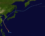
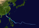
Season summary map
|
|
| Seasonal boundaries | |
| First system formed | March 25, 1963 |
| Last system dissipated | December 28, 1963 |
| Strongest storm | |
| Name | Judy |
| • Maximum winds | 280 km/h (175 mph) (1-minute sustained) |
| • Lowest pressure | 920 hPa (mbar) |
| Seasonal statistics | |
| Total depressions | 36 |
| Total storms | 25 |
| Typhoons | 19 |
| Super typhoons | 8 |
| Total fatalities | Unknown |
| Total damage | Unknown |
| Related articles | |
| Tropical depression (SSHWS) | |
| Duration | March 25 – March 25 |
|---|---|
| Peak intensity | 55 km/h (35 mph) (1-min) |
| Tropical depression (JMA) | |
| Duration | March 31 – April 6 |
|---|---|
| Peak intensity | 55 km/h (35 mph) (10-min) 1001 hPa (mbar) |
| Category 4 typhoon (SSHWS) | |
| Duration | April 26 – May 5 |
|---|---|
| Peak intensity | 230 km/h (145 mph) (1-min) 920 hPa (mbar) |
| Category 1 typhoon (SSHWS) | |
| Duration | May 27 – June 5 |
|---|---|
| Peak intensity | 130 km/h (80 mph) (1-min) 978 hPa (mbar) |
| Tropical storm (SSHWS) | |
| Duration | June 6 – June 14 |
|---|---|
| Peak intensity | 95 km/h (60 mph) (1-min) 992 hPa (mbar) |
| Category 5 super typhoon (SSHWS) | |
| Duration | June 12 – June 20 |
|---|---|
| Peak intensity | 260 km/h (160 mph) (1-min) 935 hPa (mbar) |
| Category 1 typhoon (SSHWS) | |
| Duration | June 15 – July 2 |
|---|---|
| Peak intensity | 130 km/h (80 mph) (1-min) 984 hPa (mbar) |
| Tropical storm (SSHWS) | |
| Duration | July 1 – July 9 |
|---|---|
| Peak intensity | 95 km/h (60 mph) (1-min) 990 hPa (mbar) |
| Tropical depression (PAGASA) | |
| Duration | July 11 – July 13 |
|---|---|
| Peak intensity | 55 km/h (35 mph) (10-min) |
The 1963 Pacific typhoon season has no official bounds; it ran year-round in 1963, but most tropical cyclones tend to form in the northwestern Pacific Ocean between June and December. These dates conventionally delimit the period of each year when most tropical cyclones form in the northwestern Pacific Ocean.
The scope of this article is limited to the Pacific Ocean, north of the equator and west of the international date line. Storms that form east of the date line and north of the equator are called hurricanes; see 1963 Pacific hurricane season. Tropical Storms formed in the entire west pacific basin were assigned a name by the Joint Typhoon Warning Center. Tropical depressions in this basin have the "W" suffix added to their number. Tropical depressions that enter or form in the Philippine area of responsibility are assigned a name by the Philippine Atmospheric, Geophysical and Astronomical Services Administration or PAGASA. This can often result in the same storm having two names. This was the first season in which PAGASA assigned local names to typhoons.
36 tropical depressions formed this year in the Western Pacific, of which 25 became tropical storms. 19 storms reached typhoon intensity, of which 8 reached super typhoon strength.
A brief tropical depression developed north of Papua New Guinea at 00:00 UTC on March 25, and tracked west-northwest before it dissipated later that day. Although the Joint Typhoon Warning Center does not list any maximum sustained wind values in its tracking data, the Mariners Weather Log notes that Tropical Depression 03W briefly attained winds of 55 km/h (35 mph) at its peak before dissipating.
The China Meteorological Administration (CMA) analyzed the formation of a disturbance near Micronesia on March 30, though no other agencies monitored the system. Tracking westward, the low-pressure area developed further into a tropical depression the following day. The storm turned towards the north on April 1, reaching peak intensity two days later with winds of 55 km/h and a minimum pressure of 1001 mbar (hPa; 29.56 inHg) before slowly weakening. On April 6, the depression degenerated into a remnant area of low pressure; these remnants tracked westward before dissipating early the next day.
...
Wikipedia

