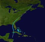
1902 Atlantic hurricane season
| Tropical storm (SSHWS) | |
| Duration | June 12 – June 16 |
|---|---|
| Peak intensity | 60 mph (95 km/h) (1-min) <997 mbar (hPa) |
| Category 1 hurricane (SSHWS) | |
| Duration | June 21 – June 28 |
|---|---|
| Peak intensity | 80 mph (130 km/h) (1-min) <995 mbar (hPa) |
| Category 2 hurricane (SSHWS) | |
| Duration | September 16 – September 22 |
|---|---|
| Peak intensity | 100 mph (155 km/h) (1-min) 981 mbar (hPa) |
| Category 2 hurricane (SSHWS) | |
| Duration | October 3 – October 11 |
|---|---|
| Peak intensity | 105 mph (165 km/h) (1-min) 970 mbar (hPa) |
| Tropical storm (SSHWS) | |
| Duration | November 1 – November 6 |
|---|---|
| Peak intensity | 70 mph (110 km/h) (1-min) <993 mbar (hPa) |
The 1902 Atlantic hurricane season featured five known tropical cyclones, three of which made landfall in the United States. The first system was initially observed in the northwestern Caribbean Sea on June 12. The last system dissipated on November 6 while located well southeast of Newfoundland. These dates fall within the period with the most tropical cyclone activity in the Atlantic. None of the systems existed simultaneously.
Of the season's five tropical cyclones, three reached hurricane status. However, none of them strengthened into major hurricanes, which are Category 3 or higher on the modern-day Saffir–Simpson hurricane wind scale. Along with 1901, this was the first time that two consecutive seasons lacked a major hurricane since 1864 and 1865. Only one storm left significant impact, which was the second hurricane. It brought flooding and strong winds to Texas, resulting in severe damage in some areas. A tornado spawned by the storm also caused five fatalities.
The season's activity was reflected with an accumulated cyclone energy (ACE) rating of 28, the lowest value since 1890. ACE is, broadly speaking, a measure of the power of the hurricane multiplied by the length of time it existed, so storms that last a long time, as well as particularly strong hurricanes, have high ACEs. It is only calculated for full advisories on tropical systems at or exceeding 39 mph (63 km/h), which is tropical storm strength.
In June, a low pressure area was observed over the western Caribbean Sea. At 12:00 UTC on June 12, a tropical depression developed about 20 miles (32 km) north of Swan Island, Honduras. The depression moved north-northeastward and intensified into a tropical storm early the next day. Later on June 13, the storm made landfall in modern-day Artemisa Province of Cuba with winds of 45 mph (75 km/h). After reaching the Gulf of Mexico late on June 13, the system continued to strengthen and peaked with maximum sustained winds of 60 mph (95 km/h). Around 23:00 UTC, it made landfall near Steinhatchee, Florida at the same intensity.
...
Wikipedia


