Techi Dam
| Techi Dam 德基水庫 |
|
|---|---|
 |
|
|
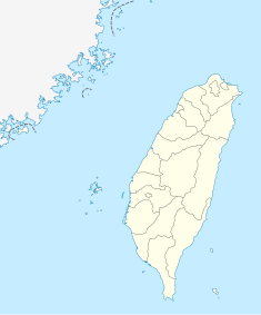
Location of Techi Dam in Taiwan
|
|
| Country | Republic of China |
| Location | Heping, Taichung, Taiwan |
| Coordinates | 24°15′19″N 121°10′03″E / 24.25528°N 121.16750°ECoordinates: 24°15′19″N 121°10′03″E / 24.25528°N 121.16750°E |
| Construction began | 1969 |
| Opening date | 1974 |
| Owner(s) | Taiwan Power Company |
| Dam and spillways | |
| Type of dam | Concrete thin arch |
| Impounds | Dajia River |
| Height | 180 m (590 ft) |
| Length | 290 m (950 ft) |
| Elevation at crest | 1,411 m (4,629 ft) |
| Reservoir | |
| Creates | Techi Reservoir |
| Total capacity | 218,150 dam3 (176,860 acre·ft) |
| Catchment area | 514 km2 (198 sq mi) |
| Surface area | 454 ha (1,120 acres) |
| Power Station | |
| Turbines | 3x 78 MW |
| Installed capacity | 234 MW |
| Annual generation | 359,000,000 kWh |
Techi Dam (Chinese: 德基水庫; pinyin: Déjī Shuǐkù; Pe̍h-ōe-jī: Tek-ki Chúi-khò͘) is a concrete thin arch dam on the Dajia River in Heping District, Taichung, Taiwan. Forming the 454 ha (1,120-acre) Techi Reservoir, the dam is built in the Tachien Gorge in Heping District, providing hydroelectric power, irrigation water, and some flood control, and is operated by the Taiwan Power Company. At 180 m (590 ft), it is the highest dam in Taiwan and one of the tallest dams in the world. The dam was completed in 1974 after five years of construction.
Proposals to dam the Dajia River date back to the Japanese occupation of Taiwan during World War II, when dams were envisioned to generate 430 megawatts (MW) of power on the river. In 1936, the Taiwan Power Company began to survey and collect data at this site, but there would be a gap of more than ten years between Taiwan's 1945 independence from Japan and the beginning of development on the Dajia River. The downstream Tienlun and Kukuan dams were built in 1956 and 1961, respectively, but with their small storage capacities, power output was highly erratic. A high dam upstream would be required to control the flow through these downstream power stations. The exceptionally narrow Tachien Gorge, located approximately 10 km (6.2 mi) upstream from Kukuan, was regarded as an excellent dam site; an engineer surveying this location remarked, "When God created Tachien, he must have had a dam in mind."
The proposed Tachien Dam site was located at the end of a long valley where the surrounding mountains abruptly closed in to form a narrow slot canyon through which flowed the Dajia River. Here, engineers planned to build a dam 237 m (778 ft) high and 319 m (1,047 ft) long, supported by a large saddle dam to the west, impounding a reservoir of 554 million cubic metres (449,000 acre·ft), forming, the second-highest arch dam in the world at the time (after Italy's Vajont Dam) and the largest artificial lake in Taiwan. The dam would support a 360 MW power station and generate over 736 million kWh per year. Of the dam's projected US$110 million cost, the United States provided a loan of about US$40 million, while Japan would provide assistance with hydraulic gates and power-generating equipment.
...
Wikipedia

