Seymchan (urban-type settlement)
| Seymchan (English) Сеймчан (Russian) |
|
|---|---|
| - Urban-type settlement - | |
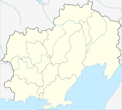
 Location of Magadan Oblast in Russia |
|
|
|
|
|
|
|
| Administrative status (as of 2010) | |
| Country | Russia |
| Federal subject | Magadan Oblast |
| Administrative district | Srednekansky District |
| Administrative center of | Srednekansky District |
| Statistics | |
| Population (2010 Census) | 2,818 inhabitants |
| Time zone | MAGT (UTC+11:00) |
Seymchan (Russian: Сеймча́н; IPA: [sʲɪjmˈtɕan]) is an urban locality (an urban-type settlement) and the administrative center of Srednekansky District of Magadan Oblast, Russia, located on the right bank of the Seymchan River, near its confluence with the Kolyma, and about 350 kilometers (220 mi) north of Magadan. Population: 2,818 (2010 Census);3,725 (2002 Census);9,963 (1989 Census).
The settlement was founded in the late 17th century by Yakuts. Its name derives from the Yakut language word Kheymchen, meaning Polynya. In the 19th century, the trade route between the Kolyma region and the Sea of Okhotsk, the Ola-Kolyma-Trakt was constructed through the settlement.
Economic development of the settlement increased with the opening of the first gold mines in 1931, and the discovery and later exploitation of brown coal reserves at Elgen in 1932, tin reserves in 1937 and cobalt ore in the early 1940s.
The construction of the modern settlement Seymchan began in 1940. During World War 2, an airfield was constructed to allow the delivery of aircraft through the Lend-Lease-Program between the Soviet Union and the USA.
...
Wikipedia

