Pickering, Ontario
| Pickering | |
|---|---|
| City (lower-tier) | |
| City of Pickering | |

Nautical Village on Lake Ontario
|
|
| Nickname(s): P-Town,PK | |
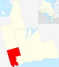
 Map showing Pickering's location in Durham Region |
|
| Map showing Pickering's location in Durham Region | |
| Coordinates: 43°50′22″N 79°4′53″W / 43.83944°N 79.08139°W | |
| Country |
|
| Province |
|
| Region | Durham (York County 1811-1852 and Ontario County 1852-1974) |
| Established | 1811 (township) 1974 (town) 2000 (city) |
| Government | |
| • Mayor | David Ryan |
| • Governing body | Pickering City Council |
| • MP | Jennifer O'Connell (Pickering—Uxbridge) |
| • MPP |
Tracy MacCharles (Pickering—Scarborough East) Joe Dickson (Ajax—Pickering) |
| Area | |
| • Total | 231.59 km2 (89.42 sq mi) |
| Elevation | 83.8 m (274.9 ft) |
| Population (2011) | |
| • Total | 88,721 (Ranked 58th) |
| • Density | 383.1/km2 (992/sq mi) |
| Time zone | Eastern (EST) (UTC−5) |
| • Summer (DST) | Eastern (EDT) (UTC−4) |
| Area code(s) | 905 / 289 / 365 |
| Highways |
|
| Website | pickering.ca |
Pickering (2011 population 88,721) is a city located in Southern Ontario, Canada, immediately east of Toronto in Durham Region. It was settled by primarily ethnic British colonists, starting in the 1770s. Most of its growth has come since the end of World War II, and it has received immigrants from around the globe.
This was Aboriginal territory for thousands of years. The Wyandot (called the Huron by Europeans), who spoke an Iroquoian language, were the historic people living here in the 15th century. Archeological remains of a large village have been found here, known as the Draper Site. Later, the Wyandot moved northwest to Georgian Bay, where they established their historic homeland. There they encountered French explorers in the early 17th century, followed by missionaries and fur traders.
The first recorded history of this area was made in 1669, when French Jesuit missionary François de Salignac de la Mothe-Fénelon noted reaching what he called the Seneca (more likely Onondaga) village of Gandatsetiagon, on the shores of Frenchman's Bay (for whom it would be named for). The Onondaga (and the Seneca) were among the Five Tribes of the Iroquois Confederacy. The Onondaga (and other Iroquois) generally occupied territory to the south and west of Lakes Ontario and Erie in present-day New York, extending into Pennsylvania and the Ohio Valley, where they maintained hunting grounds. (The Seneca were located farther west, near Seneca Lake among the Finger Lakes. Fenelon wintered at the village and started missionary work with this people.)
...
Wikipedia

