Hatch, New Mexico
| Hatch, New Mexico | |
|---|---|
| Village | |

Sign in Hatch, New Mexico
|
|
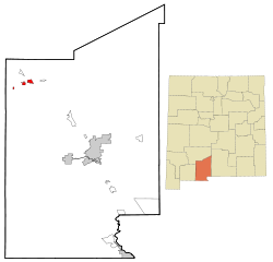
 Location of Hatch, New Mexico |
|
| Coordinates: 32°39′54″N 107°9′31″W / 32.66500°N 107.15861°WCoordinates: 32°39′54″N 107°9′31″W / 32.66500°N 107.15861°W | |
| Country | United States |
| State | New Mexico |
| County | Doña Ana |
| Area | |
| • Total | 3.0 sq mi (8.0 km2) |
| • Land | 3.0 sq mi (8.0 km2) |
| • Water | 0.0 sq mi (0.0 km2) |
| Elevation | 4,058 ft (1,237 m) |
| Population (2000) | |
| • Total | 1,673 |
| • Density | 540.2/sq mi (208.6/km2) |
| Time zone | Mountain (MST) (UTC-7) |
| • Summer (DST) | MDT (UTC-6) |
| ZIP code | 87937 |
| Area code(s) | Area code 575 |
| FIPS code | 35-31820 |
| GNIS feature ID | 0920610 |
| Website | villageofhatch.org |
Hatch is a village in Doña Ana County, New Mexico, United States. The population was 1,648 at the 2010 census. It is part of the Las Cruces Metropolitan Statistical Area. The town is experiencing moderate growth, along with its outliers of Salem, Arrey, Derry, and Rincon. Hatch is widely known as the "Chile Capital of the World," for growing a wide variety of peppers, especially the New Mexican cuisine staple, and one of New Mexico's state vegetables, the New Mexico chile.
Hatch was originally settled as Santa Barbara in 1851, however Apache raids drove the farmers away until 1853 when the nearby Fort Thorn was established. When Fort Thorn closed in 1859, the town was abandoned again in 1860. It was not until 1875 that it was re-occupied and at that time it was renamed for Indian fighter Edward Hatch, who was then commander of the New Mexico Military District.
The Hatch Chile Festival is an annual event that occurs each Labor Day. This event attracts people worldwide to a place known as the chile capital of the world. The small town has accommodated up to 30,000 people for this event. This small farming community is known worldwide for raising very good chiles. By 2012, Hatch chiles were being marketed under their name in most major urban markets in the US. Other crops such as onions, cotton, and corn are also raised there. Irrigation of local farms is accomplished by water wells as well as irrigation ditches which divert water from the Rio Grande and two lakes approximately 20 miles north of Hatch named Caballo (Spanish for "horse") and Elephant Butte Reservoir (named after a rock formation in the middle of the lake that looks similar to an elephant).
...
Wikipedia
