Zekiah Swamp
| Zekiah Swamp Natural Environment Area | |
| Maryland Natural Environment Area | |
| Named for: Zekiah Swamp | |
| Country | United States |
|---|---|
| State | Maryland |
| County | Charles County |
| Elevation | 3 ft (1 m) |
| Coordinates | 38°25′05″N 76°56′10″W / 38.41806°N 76.93611°WCoordinates: 38°25′05″N 76°56′10″W / 38.41806°N 76.93611°W |
| Area | 450 acres (182 ha) |
| Website: Charles County Greenways | |
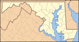
Zekiah Swamp is part of the Potomac River basin in Charles County, Maryland in the United States. The swamp is 21 miles (34 km) of braided stream stretching the length of Charles County and is a tributary of the Potomac River. It sits at an elevation of three feet (0.91 m) and 450 acres (180 ha) of its southern end is protected as the Zekiah Swamp Natural Environment Area. The Maryland Department of Natural Resources has the authority to purchase an additional 5,000 acres (2,000 ha) for the park. Charles County has moved to protect an additional 65,000 acres (26,000 ha) of the wetland. The headwaters of the swamp are protected as part of Cedarville State Forest. It was first accurately surveyed by John Henry Alexander, Maryland's official cartographer, in 1835, as "Allen's Fresh".
Maryland was formed as an English colony in 1634. One of the original Thirteen Colonies, the Province of Maryland was established by Cecilius Calvert, 2nd Baron Baltimore as a haven for Roman Catholic Englishmen. Much of Zekiah Swamp is now thickly wooded and very swampy, but during the colonial period it was a center of activity for the growing colony. A courthouse was built in 1674 and archaeologists believe they have found the location of a "summer house" constructed by colonial governor Charles Calvert, 3rd Baron Baltimore. Archaeologists have searched for a fort built in 1680 to resettle a group of "friendly" Piscataway Indians. The courthouse was built in 1674 at Moore's Lodge. It served as the Charles County courthouse until 1727 when the county government was moved to Port Tobacco. Early maps included a drawing of the courthouse. The drawing has allowed historians to know exactly what it looked like despite being unable to find its precise location for many years.
...
Wikipedia

