Charles County, Maryland
| Charles County, Maryland | |||
|---|---|---|---|
| County | |||
| Charles County | |||
|
|||
 Location in the U.S. state of Maryland |
|||
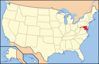
 Maryland's location in the U.S. |
|||
| Founded | April 13, 1658 | ||
| Named for | Charles Calvert | ||
| Seat | La Plata | ||
| Largest community | Waldorf | ||
| Area | |||
| • Total | 643 sq mi (1,665 km2) | ||
| • Land | 458 sq mi (1,186 km2) | ||
| • Water | 185 sq mi (479 km2), 29% | ||
| Population (est.) | |||
| • (2015) | 156,118 | ||
| • Density | 243/sq mi (94/km²) | ||
| Congressional district | 5th | ||
| Time zone | Eastern: UTC-5/-4 | ||
| Website | www |
||
Charles County is a county located in the southern central portion of the U.S. state of Maryland. As of the 2010 census, the population was 146,551. The county seat is La Plata. The county was named for Charles Calvert (1637–1715), third Baron Baltimore.
Charles County is included in the Washington-Arlington-Alexandria, DC-VA-MD-WV Metropolitan Statistical Area and the Southern Maryland region.
Charles County was created in 1658 by an Order in Council. There was also an earlier Charles County from 1650 to 1653, sometimes referred to in historic documents as Old Charles County.
In April 1865, John Wilkes Booth made his escape through Charles County after shooting President Abraham Lincoln. He was on his way to Virginia.
On April 28, 2002, a tornado cut through the County and destroyed much of downtown La Plata.
The county has a number of properties on the National Register of Historic Places. Among which, are the distinguished Green Park and the historical Pleasant Hill, home of the Green and Spalding Families.
On December 4, 2004, an arson took place in the development of Hunters Brooke which is located a few miles southeast of Indian Head. It later became the largest residential arson in the history of the state of Maryland.
...
Wikipedia


