Zearing, Iowa
| Zearing, Iowa | |
|---|---|
| City | |
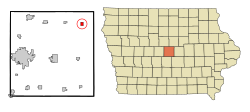
 Location of Zearing, Iowa |
|
| Coordinates: 42°9′42″N 93°17′53″W / 42.16167°N 93.29806°WCoordinates: 42°9′42″N 93°17′53″W / 42.16167°N 93.29806°W | |
| Country | United States |
| State |
|
| County | Story |
| Area | |
| • Total | 0.75 sq mi (1.94 km2) |
| • Land | 0.75 sq mi (1.94 km2) |
| • Water | 0 sq mi (0 km2) |
| Elevation | 1,056 ft (322 m) |
| Population (2010) | |
| • Total | 554 |
| • Estimate (2016) | 534 |
| • Density | 739/sq mi (285.2/km2) |
| Time zone | Central (CST) (UTC-6) |
| • Summer (DST) | CDT (UTC-5) |
| ZIP code | 50278 |
| Area code(s) | 641 |
| FIPS code | 19-87555 |
| GNIS feature ID | 0463254 |
Zearing is a city in Story County, Iowa, United States. The population was 554 at the 2010 census.
Zearing was formed out of Lincoln Township, being founded on October 17, 1881 and incorporated on February 6, 1883. It was named for William Mitchell Zearing, a judge from Chicago who donated a bell to the first church in the community.
The city celebrates Zearing Days Celebration festival during the last weekend in July. This celebration used to be held to commemorate Labor Day, but had not been put on since the 1980s, that was until 2000 when a group of Zearing residents decided to start the tradition again. Once started back up again, the first celebration -Just Horsin' Around- was titled in honor of the late Dick Sparrow's 40 horse hitch. This celebration was a one-day event in July that has now grown into a three-day event.
Zearing is served by the Colo-NESCO Community School District. Zearing's facility houses the elementary learning center(grades K-4). The district's central office is based in Colo, as well as the district's high school (grades 5-12).
Zearing is located at 42°9′42″N 93°17′53″W / 42.16167°N 93.29806°W (42.161561, -93.298038). Zearing is located 10 miles north of US Hwy 30 along US Hwy 65, 14 miles east of Interstate 35 on Story Co Rd E-18 (130th Street).
According to the United States Census Bureau, the city has a total area of 0.75 square miles (1.94 km2), all of it land.
As of the census of 2010, there were 554 people, 219 households, and 146 families residing in the city. The population density was 738.7 inhabitants per square mile (285.2/km2). There were 245 housing units at an average density of 326.7 per square mile (126.1/km2). The racial makeup of the city was 99.6% White, 0.2% African American, and 0.2% from two or more races.
...
Wikipedia
