Zacke Cox Covered Bridge
| Zacke Cox Covered Bridge | |
| National Register of Historic Places | |
|
Zacke Cox Covered Bridge
|
|
| Official name: Zacke Cox Covered Bridge | |
| Named for: Zachariah M. Cox | |
| Country | |
|---|---|
| State | |
| County | Parke |
| Township | Florida |
| Road | Tickridge Road |
| Crosses | Rock Run Creek |
| Coordinates | 39°41′42.42″N 87°17′9.44″W / 39.6951167°N 87.2859556°WCoordinates: 39°41′42.42″N 87°17′9.44″W / 39.6951167°N 87.2859556°W |
| Length | 72 ft (22 m) 54ft +9ft overhangs on each end |
| Width | 15 ft (5 m) |
| Clearance | 14 ft (4 m) |
| Load | 13 |
| Builder | Britton, J.A. |
| Design | Burr Arch truss single-span bridge |
| Material | Wood |
| Built | 1908 |
| - Repaired | 1989, 1991 $6,000, 2002 |
| Owned and Maintained by | Parke County |
| NBI Number | 6100051 |
| WGCB Number | #14-61-35 |
| Added to NRHP | Dec 22, 1978 |
| NRHP Ref# | 78000416 |
| MPS | Parke County Covered Bridges TR |
|
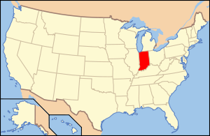
Location of Indiana in the United States
|
|
The Zacke Cox Covered Bridge is east of Mecca, Indiana. The single span Burr Arch Truss covered bridge structure was built by Joseph A. Britton in 1908.
It was added to the National Register of Historic Places in 1978.
Zachariah M. Cox was born in almost due north of this bridge in Coloma in 1857. His father was E.T. Cox and his family was quite prominent in Parke County with various family members owning nearly 1000 acres of land near the bridge.
Northwest of the mine is an old clay strip mine and coal and slate outcroppings can be viewed south of the bridge.
This bridge, along with the Harry Evans Covered Bridge and the Weisner Covered Bridge, all built by J.A. Britton, lack the traditional Britton Portals. Instead, they have a more semi-arched portal that more resembles the Hendricks Portals of the Wilkins Mill Covered Bridge or the Rush Creek Covered Bridge.
...
Wikipedia


