Rush Creek Covered Bridge
| Rush Creek Covered Bridge | |
| National Register of Historic Places | |
|
Rush Creek Covered Bridge
|
|
| Official name: Rush Creek Covered Bridge | |
| Named for: Rush Creek | |
| Country | |
|---|---|
| State | |
| County | Parke |
| Township | Liberty |
| Road | C.R. 900N |
| Crosses | Rush Creek |
| Coordinates | 39°53′55.54″N 87°18′52.75″W / 39.8987611°N 87.3146528°WCoordinates: 39°53′55.54″N 87°18′52.75″W / 39.8987611°N 87.3146528°W |
| Length | 95 ft (29 m) 77ft +9ft overhangs on each end |
| Width | 16 ft (5 m) |
| Clearance | 12.5 ft (4 m) |
| Load | 5 tons |
| Builder | Hendricks, William |
| Design | Burr Arch truss single-span bridge |
| Material | Wood |
| Built | 1904 |
| - Rebuilt | 1977 |
| Owned and Maintained by | Parke County |
| NBI Number | 6100154 |
| WGCB Number | #14-61-31 |
| Added to NRHP | Dec 22, 1978 |
| NRHP Ref# | 78000410 |
| MPS | Parke County Covered Bridges TR |
|
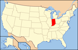
Location of Indiana in the United States
|
|
The Rush Creek Covered Bridge is south of Tangier, Indiana. The single span Burr Arch covered bridge structure was built by William Hendricks in 1904.
It was added to the National Register of Historic Places in 1978.
This is the first of three bridges that would be built by William Hendricks. The other two are Wilkins Mill Covered Bridge,1906, and Mill Creek Covered Bridge,1907. All three are of similar construction with very shallow portals.
Rush Creek Covered Bridge, circa 1990
...
Wikipedia


