York County, Virginia
| York County, Virginia | ||
|---|---|---|

York County Courthouse
|
||
|
||
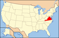
 Location in the U.S. state of Virginia |
||
 Virginia's location in the U.S. |
||
| Founded | 1634 | |
| Named for | York | |
| Seat | Yorktown | |
| Largest community | Bethel Manor | |
| Area | ||
| • Total | 215 sq mi (557 km2) | |
| • Land | 105 sq mi (272 km2) | |
| • Water | 110 sq mi (285 km2), 51.3% | |
| Population (est.) | ||
| • (2015) | 67,837 | |
| • Density | 533/sq mi (206/km²) | |
| Congressional district | 1st | |
| Time zone | Eastern: UTC-5/-4 | |
| Website | www |
|
York County (formerly Charles River County) is a county in the eastern part of the Commonwealth of Virginia, located in the Tidewater. As of the 2010 census, the population was 65,464. The county seat is the unincorporated town of Yorktown.
Located on the north side of the Virginia Peninsula, with the York River as its northern border, York County is included in the Virginia Beach–Norfolk–Newport News, VA–NC Metropolitan Statistical Area.
York County contains many tributaries of the York River. It shares land borders with the independent cities of Williamsburg, Newport News, Hampton, and Poquoson, as well as James City County, and shares a border along the York River with Gloucester County.
Formed in 1634 as one of the eight original shires (counties) of the Virginia Colony, York County is one of the oldest counties in the United States. Yorktown is one of the three points of the Historic Triangle of Colonial Virginia. It is the site of the last battle and surrender of British forces in 1781 at the conclusion of the American Revolutionary War, when the patriots gained independence from Great Britain.
...
Wikipedia

