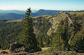
Yolla Bolly-Middle Eel Wilderness
| Yolla Bolly–Middle Eel Wilderness | |
|---|---|
|
IUCN category Ib (wilderness area)
|
|
 |
|
|
Map of the United States
|
|
| Location | Yolla Bolly Range of the Klamath Mountains and Inner Northern California Coast Ranges; Tehama / Trinity / Mendocino Counties, California, United States |
| Nearest city | Covelo, California |
| Coordinates | 40°03′45″N 123°13′19″W / 40.06250°N 123.22194°WCoordinates: 40°03′45″N 123°13′19″W / 40.06250°N 123.22194°W |
| Area | 180,877 acres (731.98 km2) |
| Established | 1964 |
| Governing body | U.S. Forest Service / Bureau of Land Management |
The Yolla Bolly–Middle Eel Wilderness is a federally designated wilderness area in the Yolla Bolly Range of the southern Klamath Mountains and the Inner Northern California Coast Ranges, in Northern California.
The wilderness area is located northeast of Covelo, 45 miles (72 km) west of Red Bluff and Interstate 5, and east of Garberville and U.S. Route 101. It is within sections of eastern Mendocino County, western Tehama County, and Trinity County.
The Yolla Bolly–Middle Eel Wilderness was created by the Wilderness Act of 1964, with an original land area of 170,195 acres (68,875 ha). It was enlarged by the California Wilderness Act of 1984, and again by the Northern California Coastal Wild Heritage Wilderness Act of 2006, for a present-day total of 180,877 acres (73,198 ha).
Most of the area (172,998 acres) is managed by the US Forest Service and is within three national forest boundaries, the: Mendocino National Forest, Shasta-Trinity National Forest and Six Rivers National Forest. The remaining 7,879 acres (31.89 km2) is managed by the Bureau of Land Management. The name is a combination of: a phrase from the Native American Wintun language of the region's Wintun peoples, Yo-la meant snow-covered, and Bo-li meant high peak; and a reference to the Middle fork of the Eel River.
...
Wikipedia

