Red Bluff, California
| City of Red Bluff | |
|---|---|
| City | |

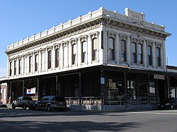
A historic building in 2009.
|
|
| Motto: "A Great Place To Live" | |
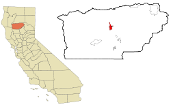
 Location in Tehama County and the state of California |
|
| Location in the United States | |
| Coordinates: 40°10′36″N 122°14′17″W / 40.17667°N 122.23806°WCoordinates: 40°10′36″N 122°14′17″W / 40.17667°N 122.23806°W | |
| Country | United States |
| State | California |
| County | Tehama |
| Incorporated | March 31, 1876 |
| Area | |
| • City | 7.677 sq mi (19.882 km2) |
| • Land | 7.563 sq mi (19.587 km2) |
| • Water | 0.114 sq mi (0.295 km2) 1.48% |
| Elevation | 305 ft (93 m) |
| Population (April 1, 2010) | |
| • City | 14,076 |
| • Estimate (2013) | 14,104 |
| • Density | 1,800/sq mi (710/km2) |
| • Urban | 18,434 |
| Time zone | Pacific (PST) (UTC-8) |
| • Summer (DST) | PDT (UTC-7) |
| ZIP code | 96080 |
| Area code | 530 |
| FIPS code | 06-59892 |
| GNIS feature IDs | 277581, 2411527 |
| Website | www |
Red Bluff is a city in and the county seat of Tehama County, California, United States. The population was 14,076 at the 2010 census, up from 13,147 at the 2000 census.
Red Bluff is on the northern edge of the Sacramento Valley, and is the third largest city in the Shasta Cascade region. It is about 30 mi (48 km) south of Redding, 40 mi (64 km) northwest of Chico, and 125 mi (201 km) north of Sacramento.
The city is located at 40°10′36″N 122°14′17″W / 40.17667°N 122.23806°W (40.176640, -122.237951). According to the United States Census Bureau, the city has a total area of 7.7 square miles (20 km2). 7.6 square miles (20 km2) of it is land and 0.1 square miles (0.26 km2) of it is water. The total area is 1.48% water.
The Nomlaki (Central Wintun) and Southern Yana people originally inhabited the area along the banks of the Sacramento River where Red Bluff was built. Most of the native population of the area are thought to have died in a malaria epidemic or smallpox epidemic brought by trappers in the early 1830s, shortly before white settlers arrived in the 1840s.
...
Wikipedia

