Yevpatoria
|
Yevpatoria Евпатория Євпаторія Kezlev |
|||
|---|---|---|---|

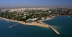
Eupatoria panorama
|
|||
|
|||
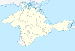
| Location of Eupatoriya within Crimea | |||
| Coordinates: 45°11′38″N 33°22′5″E / 45.19389°N 33.36806°ECoordinates: 45°11′38″N 33°22′5″E / 45.19389°N 33.36806°E | |||
| Country | Claimed by: Disputed: | ||
| Republic |
|
||
| Region | Eupatoria municipality | ||
| Area | |||
| • Total | 120 km2 (50 sq mi) | ||
| Elevation | 10 m (30 ft) | ||
| Population (2014) | |||
| • Total | 105,719 | ||
| • Density | 1,618.37/km2 (4,191.6/sq mi) | ||
| Time zone | MSK (UTC+3) | ||
| Postal code | 97400 — 97490 | ||
| Area code(s) | +7-36569 | ||
| Climate | Cfa | ||
| Website | www |
||
Yevpatoria or Eupatoria is a city of regional significance in Crimea, a territory disputed between Ukraine (as the Autonomous Republic of Crimea) and Russia (as the Republic of Crimea) after Russia annexed Crimea in March 2014. Eupatoria serves as the administrative center of Eupatoria municipality, one of the districts (raions) into which Crimea is divided. Population: 105,719 (2014 Census).
The first recorded settlement in the area, called Kerkinitis (Κερκινίτις), was built by Greek colonists around 500 BC. Along with the rest of Crimea, Kerkinitis was part of the dominions of Mithridates VI, King of Pontus, from whose nickname, Eupator, the city's modern name derives.
From roughly the 7th through the 10th centuries AD, Eupatoriya was a Khazar settlement; its name in Khazar language was probably Güzliev (literally "beautiful house"). It was later subject to the Cumans (Kipchaks), the Mongols and the Crimean Khanate. During this period the city was called Kezlev by Crimean Tatars and Gözleve by Ottomans. The Russian medieval name Kozlov is a Russification of the Crimean Tatar name.
...
Wikipedia


