Xenia, OH
| Xenia, Ohio | |
|---|---|
| City | |

L TO R: Greene County Courthouse, Collier Chapel, Shawnee Park, Xenia City Hall, B&O Railroad Caboose
|
|
| Nickname(s): "City of Hospitality", "Bicycle Capital of the Midwest", "X-Town" | |
| Motto: "Vivid History, Vibrant Future" | |
 Location of Xenia, Ohio |
|
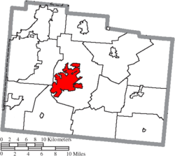
 Location of Xenia in Greene County |
|
| Coordinates: 39°41′1″N 83°56′17″W / 39.68361°N 83.93806°WCoordinates: 39°41′1″N 83°56′17″W / 39.68361°N 83.93806°W | |
| Country | United States |
| State | Ohio |
| County | Greene |
| Founded | 1803 |
| Government | |
| • Mayor | Marsha J. Bayless |
| • City Manager | Brent Merriman |
| Area | |
| • Total | 13.29 sq mi (34.42 km2) |
| • Land | 13.28 sq mi (34.40 km2) |
| • Water | 0.01 sq mi (0.03 km2) |
| Elevation | 932 ft (284 m) |
| Population (2010) | |
| • Total | 25,719 |
| • Estimate (2012) | 25,944 |
| • Density | 1,936.7/sq mi (747.8/km2) |
| • Demonym | Xenian |
| Time zone | Eastern (EST) (UTC-5) |
| • Summer (DST) | EDT (UTC-4) |
| ZIP code | 45385 |
| Area code(s) | 937 |
| FIPS code | 39-86772 |
| GNIS feature ID | 1061805 |
| Website | http://www.ci.xenia.oh.us/ |
Xenia (/ˈziːnjə/ ZEEN-yə) is a city in and the county seat of Greene County, Ohio, United States. The municipality is located in southwestern Ohio 21 miles (34 km) from Dayton and is part of the Dayton Metropolitan Statistical Area, as well as the Miami Valley region. The name comes from the Greek word Xenia (ξενία), which means "hospitality".
As of the 2010 census, the city had a population of 25,719. Xenia is the third largest city by population in Greene County, behind Fairborn and Beavercreek. It serves as the county seat of Greene County, being at the geographical center, and housing the County Courthouse, the County Sheriff's Department, Jail, and other Government departments. By population, it is the largest place in the United States whose name begins with the letter X.
Xenia was founded in 1803, the year Ohio was admitted into the Union. In that year, pioneer John Paul bought 2,000 acres (8.1 km2) of land from Thomas and Elizabeth Richardson of Hanover County, Virginia, for "1050 pounds current moneys of Virginia." Paul influenced county commissioners to locate the county seat on this land at the forks of the Shawnee Creeks.
Joseph C. Vance was named to survey the site and lay out the town. The following year, he bought the town site of 257 acres (1.04 km2) from John Paul for $250. The name of the new village was chosen in typically democratic fashion. Vance called a town meeting to discuss possible names. The committee had considered several suggestions without reaching any decision. Then the Rev. Robert Armstrong proposed the name "Xenia," meaning "hospitality" in Greek, because of the fine hospitality extended to him in this friendly community. When a tie vote occurred, Laticia Davis, wife of Owen Davis, was invited to cast the deciding ballot. She voted for "Xenia."
...
Wikipedia
