Hanover County, Virginia
| Hanover County, Virginia | ||
|---|---|---|

Current Hanover County Courthouse
|
||
|
||
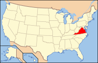
 Location in the U.S. state of Virginia |
||
 Virginia's location in the U.S. |
||
| Founded | 1720 | |
| Named for | Electorate of Hanover | |
| Seat | Hanover Courthouse | |
| Largest town | Ashland | |
| Area | ||
| • Total | 474 sq mi (1,228 km2) | |
| • Land | 469 sq mi (1,215 km2) | |
| • Water | 5 sq mi (13 km2), 1.1% | |
| Population | ||
| • (2010) | 99,863 | |
| • Density | 213/sq mi (82.2/km²) | |
| Congressional district | 7th | |
| Time zone | Eastern: UTC-5/-4 | |
| Website | www |
|
Hanover County is located in the Commonwealth of Virginia. As of the 2010 census, the population was 99,863. Its county seat is Hanover Courthouse.
Hanover County is included in the Greater Richmond Region.
Located in the Piedmont of Virginia, Hanover County was created on November 26, 1719, from the area of New Kent County called St. Paul's Parish. It was named for the Electorate of Hanover in Germany, because King George I of Great Britain was Elector of Hanover at the time. The county was developed by planters moving west from the Virginia tidewater, where soils had been exhausted by tobacco monoculture.
Hanover County was the birthplace and home of noted American statesman Patrick Henry. He reportedly married Sarah Shelton in the parlor of her family's house, Rural Plains, also known as Shelton House. At the Hanover Courthouse, Henry argued the case of the Parson's Cause in 1763, attacking the British Crown's attempt to set the salaries of clergy in the colony regardless of conditions in the local economy. The historic Hanover Courthouse is pictured in the county seal. Hanover County was also the birthplace of Henry Clay, who became known as a politician in Kentucky, author of the Missouri Compromise of 1820, and Secretary of State.
...
Wikipedia

