Woolwich, New South Wales
|
Woolwich Sydney, New South Wales |
|||||||||||||
|---|---|---|---|---|---|---|---|---|---|---|---|---|---|

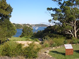
Woolwich Lookout
|
|||||||||||||
| Coordinates | 33°50′30″S 151°10′11″E / 33.8417°S 151.16968°ECoordinates: 33°50′30″S 151°10′11″E / 33.8417°S 151.16968°E | ||||||||||||
| Population | 811 (2006 census) | ||||||||||||
| Postcode(s) | 2110 | ||||||||||||
| Location | 11 km (7 mi) west of Sydney CBD | ||||||||||||
| LGA(s) | Municipality of Hunter's Hill | ||||||||||||
| State electorate(s) | Lane Cove | ||||||||||||
| Federal Division(s) | North Sydney | ||||||||||||
|
|||||||||||||
Woolwich is a suburb on the lower North Shore of Sydney, in the state of New South Wales, Australia. Woolwich is located 11 kilometres north-west of the Sydney central business district, in the local government area of the Municipality of Hunter's Hill. Woolwich sits on the peninsula between the Lane Cove River and the Parramatta River, jutting out from Hunters Hill.
The suburb's name is derived from its namesake Woolwich, by the banks of the Thames in London. Parramatta River had been known as the 'Thames of the Antipodes' and other nearby suburbs were also named after Thames localities of Greenwich, Putney and Henley.
The area's Aboriginal name is 'Mookaboola' or 'Moocooboola', which means meeting of waters. An early settler was John Clarke, who bought land here in 1834 and is responsible for naming Clarke's Point. Samuel Onion was another early land owner with an ironmongery business and he gave the suburb its first name 'Onion Point' in 1835.
The world's first, union-led green ban was placed on the suburb. Jack Mundey and his followers in the Builder's Labourers Federation did not support the destruction of local habitat. They eventually won their battle and 'Kelly's Bush' remains today.
...
Wikipedia

