Wollemi National Park
|
Wollemi National Park New South Wales |
|
|---|---|
|
IUCN category Ib (wilderness area)
|
|

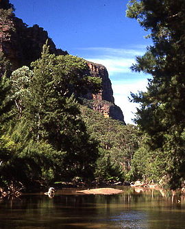
Capertee River, located within the southern portion of the national park.
|
|
| Nearest town or city | Lithgow |
| Coordinates | 32°52′26″S 150°29′32″E / 32.87389°S 150.49222°ECoordinates: 32°52′26″S 150°29′32″E / 32.87389°S 150.49222°E |
| Established | December 1979 |
| Area | 5,017 km2 (1,937.1 sq mi) |
| Managing authorities | NSW National Parks and Wildlife Service |
| Website | Wollemi National Park |
| See also | Protected areas of New South Wales |
The Wollemi National Park is a protected national park and wilderness area that is located in the northern Blue Mountains and Lower Hunter regions of New South Wales, in eastern Australia. The 501,703-hectare (1,239,740-acre) park, the second largest national park in New South Wales, contains the 361,113-hectare (892,330-acre) Wollemi Wilderness – the largest such wilderness area in Australia – and is situated approximately 130 kilometres (81 mi) northwest of Sydney.
The Wollemi National Park is one of the eight protected areas that, in 2000, was enscribed to form part of the UNESCO World Heritage–listed Greater Blue Mountains Area. The Wollemi National Park is the most north–westerly of the eight protected areas within the World Heritage Site. The national park forms part of the Great Dividing Range.
It contains the only known living wild specimens of the Wollemi Pine (Wollemia nobilis), a species thought to have become extinct on the mainland approximately thirty million years ago, but discovered alive in three small stands in 1994.
The national park is bounded to the north by the Goulburn River National Park and the Bylong Valley Way; to the east by the Yengo National Park, the Parr State Conservation Area, and the Putty Road; to the south by the Blue Mountains National Park and the Bells Line of Road; to the south–west by the Wolgan Valley and the Gardens of Stone National Park; and to the west by open farmland that surround the towns of Rylstone and Kandos and the Capertee Valley.
...
Wikipedia

