Blue Mountains (New South Wales)
|
Blue Mountains New South Wales |
|||||||||||||
|---|---|---|---|---|---|---|---|---|---|---|---|---|---|

The Three Sisters sandstone rock formation, one of the region's best-known attractions
|
|||||||||||||
| Coordinates | 33°43′05″S 150°18′38″E / 33.71806°S 150.31056°ECoordinates: 33°43′05″S 150°18′38″E / 33.71806°S 150.31056°E | ||||||||||||
| Population | 162,000 (2006?) | ||||||||||||
| • Density | 14.21/km2 (36.81/sq mi) | ||||||||||||
| Area | 11,400 km2 (4,401.6 sq mi) | ||||||||||||
| Location | 50 km (31 mi) NW of Sydney CBD | ||||||||||||
| LGA(s) | Blue Mountains, City of Hawkesbury, City of Lithgow and Oberon Shire | ||||||||||||
| State electorate(s) | Blue Mountains, Penrith, Bathurst, Hawkesbury, Londonderry and Riverstone | ||||||||||||
| Federal Division(s) | Macquarie, Lindsay, and Calare | ||||||||||||
|
|||||||||||||
| Blue Mountains Range | |
|---|---|
| Blue Mountains | |

The characteristic blue haze,
as seen in the Jamison Valley |
|
| Highest point | |
| Peak | unnamed peak (north-east of Lithgow) |
| Elevation | 1,189 m (3,901 ft) AHD |
| Coordinates | |
| Dimensions | |
| Length | 96 km (60 mi) NW/SE |
| Geography | |
|
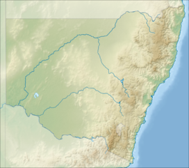
Location of the Blue Mountains Range
in New South Wales |
|
| Country | Australia |
| State | New South Wales |
The Blue Mountains is a mountainous region and a mountain range located in New South Wales, Australia. The region borders on Sydney's metropolitan area, its foothills starting about 50 kilometres (31 mi) west of the state capital. The public's understanding of the extent of the Blue Mountains is varied, as it forms only part of an extensive mountainous area associated with the Great Dividing Range. Officially the Blue Mountains region is bounded by the Nepean and Hawkesbury rivers in the east, the Coxs River and Lake Burragorang to the west and south, and the Wolgan and Colo rivers to the north. Geologically, it is situated in the central parts of the Sydney Basin.
The Blue Mountains Range comprises a range of mountains, plateaux and escarpments extending off the Great Dividing Range about 4.8 kilometres (3.0 mi) northwest of Wolgan Gap in a generally southeasternly direction for about 96 kilometres (60 mi), terminating at Emu Plains. For about two thirds of its length it is traversed by the Great Western Highway and the Main Western railway line. Several established towns are situated on its heights, including Katoomba, Blackheath, Mount Victoria, and Springwood. The range forms the watershed between Coxs River to the south and the Grose and Wolgan rivers to the north. The range contains the Explorer Range and the Bell Range.
...
Wikipedia

