Winslow, AZ
| Winslow, Arizona | |
|---|---|
| City | |

Standin' on the Corner Park and mural
|
|
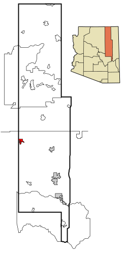
 Location in Navajo County and the state of Arizona |
|
 U.S. Census Map |
|
| Location in the United States | |
| Coordinates: 35°1′43″N 110°42′3″W / 35.02861°N 110.70083°WCoordinates: 35°1′43″N 110°42′3″W / 35.02861°N 110.70083°W | |
| Country | United States |
| State | Arizona |
| County | Navajo |
| Incorporated | 1900 |
| Government | |
| • Mayor | Robin R. Boyd |
| Area | |
| • Total | 12.3 sq mi (31.9 km2) |
| • Land | 12.3 sq mi (31.9 km2) |
| • Water | 0.0 sq mi (0.0 km2) |
| Elevation | 4,850 ft (1,478 m) |
| Population (2010) | |
| • Total | 9,655 |
| • Estimate (2014) | 9,604 |
| • Density | 773.1/sq mi (298.5/km2) |
| Time zone | MST (UTC-7) |
| ZIP code | 86047 |
| Area code(s) | 928 |
| FIPS code | 04-83930 |
| Website | City of Winslow |
Winslow (Navajo: Béésh Sinil) is a city in Navajo County, Arizona, United States. According to the 2010 census, the population of the city is 9,655.
Winslow was named for either Edward F. Winslow, president of St. Louis and San Francisco Rail Road, which owned one half of the old Atlantic and Pacific Railroad, or Tom Winslow, a prospector who lived in the area.
The last Harvey House (La Posada Hotel) opened in 1930. It was designed by Mary Colter. The hotel closed in 1957 and was used by the Santa Fe Railway for offices. The railroad abandoned La Posada in 1994 and announced plans to tear it down. It was bought and restored by Allan Affeldt and it currently serves as a hotel.
U.S. Route 66 was originally routed through the city. A contract to build Interstate 40 as a bypass north of Winslow was awarded at the end of 1977. I-40 replaced U.S. Route 66 in Arizona in its entirety.
Winslow achieved national fame in 1972 in the Eagles / Jackson Browne song “Take it Easy” which has the line “standing on a corner in Winslow, Arizona."
As of the census of 2000, there were 9,520 people, 2,754 households, and 1,991 families residing in the city. The population density was 773.1 people per square mile (298.6/km²). There were 3,198 housing units at an average density of 259.7 per square mile (100.3/km²). The racial makeup of the city was 40.8% White, 5.18% Black or African American, 23.47% Native American, 1.03% Asian, 0.09% Pacific Islander, 13.49% from other races, and 4.18% from two or more races. 28.84% of the population were Hispanic or Latino of any race.
...
Wikipedia

