Wilmot Township, Bradford County, Pennsylvania
| Wilmot Township, Pennsylvania |
|
|---|---|
| Township | |
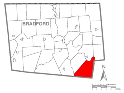
 Map of Bradford County with Wilmot Township highlighted |
|
 Map of Bradford County, Pennsylvania |
|
| Country | United States |
| State | Pennsylvania |
| County | Bradford |
| Settled | 1784 |
| Incorporated | 1849 |
| Area | |
| • Total | 44.7 sq mi (115.9 km2) |
| • Land | 43.8 sq mi (113.4 km2) |
| • Water | 1.0 sq mi (2.5 km2) |
| Population (2010) | |
| • Total | 2,279 |
| • Estimate (2016) | 1,162 |
| • Density | 27/sq mi (10.6/km2) |
| Area code(s) | 570 |
| FIPS code | 42-015-85544 |
Wilmot Township is a township in Bradford County, Pennsylvania, United States. The population was 1,204 at the 2010 census.
Wilmot Township is located in southeastern Bradford County and is bordered by Albany Township to the west, Terry Township to the northwest, and by Wyalusing Township and Tuscarora Township to the north across the Susquehanna River. To the east, in Wyoming County, are Braintrim, Windham, and North Branch townships, and to the south, in Sullivan County, are Colley and Cherry townships. The unincorporated community of Sugar Run is located in the north part of the township along the Susquehanna River.
According to the United States Census Bureau, the township has a total area of 44.7 square miles (115.9 km2), of which 43.8 square miles (113.4 km2) is land and 0.97 square miles (2.5 km2), or 2.17%, is water.
As of the census of 2000, there were 1,177 people, 454 households, and 339 families residing in the township. The population density was 26.8 people per square mile (10.3/km²). There were 723 housing units at an average density of 16.5/sq mi (6.4/km²). The racial makeup of the township was 98.22% White, 0.34% African American, 0.08% Native American, 0.25% Asian, 0.08% Pacific Islander, 0.25% from other races, and 0.76% from two or more races. Hispanic or Latino of any race were 0.51% of the population.
...
Wikipedia
