Williston Municipal Airport
| Williston Municipal Airport | |||||||||||||||
|---|---|---|---|---|---|---|---|---|---|---|---|---|---|---|---|
| Summary | |||||||||||||||
| Airport type | Public | ||||||||||||||
| Owner | City of Williston | ||||||||||||||
| Serves | Williston, Florida | ||||||||||||||
| Elevation AMSL | 75 ft / 23 m | ||||||||||||||
| Coordinates | 29°21′21″N 082°28′19″W / 29.35583°N 82.47194°WCoordinates: 29°21′21″N 082°28′19″W / 29.35583°N 82.47194°W | ||||||||||||||
| Map | |||||||||||||||
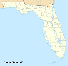
| Location of airport in Florida | |||||||||||||||
| Runways | |||||||||||||||
|
|||||||||||||||
| Statistics (2010) | |||||||||||||||
|
|||||||||||||||
|
Source: Federal Aviation Administration
|
|||||||||||||||
| Aircraft operations | 16,250 |
|---|---|
| Based aircraft | 51 |
Williston Municipal Airport (FAA LID: X60) is a city-owned, public-use airport located two nautical miles (4 km) southwest of the central business district of Williston, a city in Levy County, Florida, United States. Commonly referred to as Williston Airport, it is located 23 miles (37 km) southwest of Gainesville Regional Airport (GNV). Opened in 1974 for public use, it does not have a control tower.
This airport is included in the National Plan of Integrated Airport Systems for 2011–2015, which categorized it as a general aviation facility.
Within 5 miles (8 km) of the airport are the internationally known dive springs of Devil's Den and Blue Grotto.
Formerly known as Montbrook Army Air Field during World War II, the airfield was opened as a US Army Air Forces installation on January 1, 1942. It appears to have been closed by the end of 1944.
In 1974, the facility was deeded to the City of Williston. It serves as a basic utility airport in Levy County for the City of Archer, City of Bronson, City of McIntosh, City of Reddick and the City of Williston. It is one of two airports in the county, serving alongside the George T. Lewis Airport in Cedar Key.
...
Wikipedia

