Wildstrubel
| Wildstrubel | |
|---|---|

The north-west side from the Simmental
|
|
| Highest point | |
| Elevation | 3,244 m (10,643 ft) |
| Prominence | 815 m (2,674 ft) |
| Isolation | 9.2 km (5.7 mi) |
| Parent peak | Wildhorn |
| Listing | Alpine mountains above 3000 m |
| Coordinates | 46°24′01″N 7°31′43″E / 46.40028°N 7.52861°ECoordinates: 46°24′01″N 7°31′43″E / 46.40028°N 7.52861°E |
| Geography | |
| Location | Bern/Valais, Switzerland |
| Parent range | Bernese Alps |
| Climbing | |
| First ascent | Probably: Summer 1855 by Jakob Tritten and Dr. M. Schmid "Lenkerstrubel" 16 August 1856 by Edmund von Fellenberg and Jakob Tritten "Mittelgipfel" 8 September 1857 by Thomas W. Hinchcliff, Brandshaw Smith, and Zacharie Cachat |
| Easiest route | glacier tour, rock (II) |
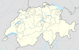
The Wildstrubel (3,244 metres (10,643 ft)) is a mountain of the Alps, straddling the border between the Swiss cantons of Bern and Valais. It forms a large glaciated massif, about 15 km wide, extending between the Rawil Pass and the Gemmi Pass. Along with the Muverans, the Diablerets and the Wildhorn, the Wildstrubel is one the four distinct mountain massifs of the Bernese Alps that lie west of the Gemmi Pass. The massif of the Wildstrubel is at the centre between the valleys of Simmental (BE), Engstligental (BE) and the Rhone (VS), the exact location of the tripoint being the summit of the Schneehorn. It comprises several distinct summits, including (from west to east) the Wetzsteinhorn, the Rohrbachstein, the Weisshorn, the Pointe de la Plaine Morte, Mont Bonvin, the and the Schneehorn. The main crest with the almost equally high summits of the Mittelgipfel (3,243.5 m) and the Grossstrubel (3,243 m) forms an amphitheatre oriented eastward which ends at the Steghorn and the Daubenhorn. This area encloses the Wildstrubel Glacier. To the southwest, the Wildstrubel overlooks the high glacier plateau of the Plaine Morte, which also includes an unnamed lake below the Schneehorn.
The Wildstrubel lies approximately halfway between Lenk (BE; 9 km), Sierre (VS; 12 km) and Adelboden (BE; 10 km), its summit being in the municipalities of Lenk and Leukerbad. The nearest settlement is the Oberried section of Lenk, at the head of the Simmental. Other notable towns and resorts around the massif are Crans-Montana, Aminona, Leukerbad and Inden. The highest place that can be reached without effort is the Pointe de la Plaine Morte station (2,882 m), which is connected to Cran-Montana and within 5 km from the summit.
...
Wikipedia

