Wildhorn
| Wildhorn | |
|---|---|

View from the north side
|
|
| Highest point | |
| Elevation | 3,248 m (10,656 ft) |
| Prominence | 978 m (3,209 ft) |
| Isolation | 22.9 km (14.2 mi) |
| Parent peak | Finsteraarhorn |
| Coordinates | 46°21′16.5″N 7°21′39.1″E / 46.354583°N 7.360861°ECoordinates: 46°21′16.5″N 7°21′39.1″E / 46.354583°N 7.360861°E |
| Geography | |
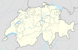
| Location | Bern/Valais, Switzerland |
| Parent range | Bernese Alps |
| Climbing | |
| First ascent | September 1843 by Gottlieb Samuel Studer |
The Wildhorn is a mountain of the Alps, straddling the border between the Swiss cantons of Bern and Valais. At 3,248 metres (10,656 ft) above sea level, it is the highest summit of the Bernese Alps west of the Gemmi Pass. It forms a large glaciated massif, about 10 km wide, extending between the Sanetsch Pass and the Rawil Pass. Along with the Muverans, the Diablerets and the Wildstrubel, the Wildhorn is one the four distinct mountain massifs of the Bernese Alps that lie west of the Gemmi Pass. The massif of the Wildhorn is at the centre between the valleys of the Saane, Simme (both canton of Bern) and the Rhone (Valais). It comprises several distinct summits, including (from west to east) the , Le Sérac, the Geltenhorn, the Sex Noir, the Sex Rouge, the Schnidehorn and the Six des Eaux Froides. The main crest is between the glaciers named Tungelgletscher and Glacier du Wildhorn. South of the main summit is the almost equally high summit of Mont Pucel (3,177 m). The Wildhorn is surrounded by several large mountain lakes: the Lac de Sénin, the Lauenensee, the Iffigsee, the Lac de Tseuzier and the Lac des Audannes. The Tungelgletscher, on the north-east face, was measured as 1.9 km in length in 1973.
...
Wikipedia

