Wilderswil
| Wilderswil | ||
|---|---|---|

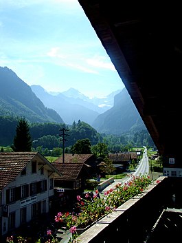
The valley of the Lütschine river, seen from Wilderswil
|
||
|
||
| Coordinates: 46°40′N 7°52′E / 46.667°N 7.867°ECoordinates: 46°40′N 7°52′E / 46.667°N 7.867°E | ||
| Country | Switzerland | |
| Canton | Bern | |
| District | Interlaken-Oberhasli | |
| Government | ||
| • Mayor | M Eduard Schild | |
| Area | ||
| • Total | 13.54 km2 (5.23 sq mi) | |
| Elevation | 586 m (1,923 ft) | |
| Population (Dec 2015) | ||
| • Total | 2,614 | |
| • Density | 190/km2 (500/sq mi) | |
| Postal code | 3812 | |
| SFOS number | 0594 | |
| Surrounded by | Bönigen, Därligen, Gsteigwiler, Gündlischwand, Lauterbrunnen, Matten bei Interlaken, Saxeten | |
| Website |
www SFSO statistics |
|
Wilderswil is a village and a municipality in the Interlaken-Oberhasli administrative district in the canton of Bern in Switzerland.
Wilderswil belongs to the Small Agglomeration Interlaken with 23,300 inhabitants (2014).
The village of Wilderswil is situated at the southern border of the Bödeli, the tongue of land between Lake Thun and Lake Brienz in the Bernese Oberland region. It lies at the entrance to the mountain valleys containing the Lütschine river and its tributary the Saxetenbach, and is some 4 km (2.5 mi) south of Interlaken, the main town of the Bödeli.
The municipality extends for some 8 km (5.0 mi) from the village, along the west bank of the Lütschine river, and includes the flanks of the mountains that border that valley to the west. Its altitude ranges from some 580 m (1,900 ft), on the Bödeli plain, to 2,413 m (7,917 ft), at the summit of Sulegg. It consists of the villages of Wilderswil, Mülenen and Gsteigallmend.
Wilderswil has an area of 13.54 km2 (5.23 sq mi). Of this area, 2.67 km2 (1.03 sq mi) or 19.7% is used for agricultural purposes, while 7.77 km2 (3.00 sq mi) or 57.4% is forested. Of the rest of the land, 1.35 km2 (0.52 sq mi) or 10.0% is settled (buildings or roads), 0.18 km2 (0.069 sq mi) or 1.3% is either rivers or lakes and 1.57 km2 (0.61 sq mi) or 11.6% is unproductive land.
Of the built up area, housing and buildings made up 3.8% and transportation infrastructure made up 4.4%. Out of the forested land, 53.8% of the total land area is heavily forested and 2.7% is covered with orchards or small clusters of trees. Of the agricultural land, 2.2% is used for growing crops and 7.7% is pastures and 9.5% is used for alpine pastures. All the water in the municipality is flowing water. Of the unproductive areas, 6.7% is unproductive vegetation and 4.9% is too rocky for vegetation.
...
Wikipedia


