Gsteigwiler
| Gsteigwiler | ||
|---|---|---|

Gsteig bei Interlaken village church
|
||
|
||
| Coordinates: 46°39′N 7°52′E / 46.650°N 7.867°ECoordinates: 46°39′N 7°52′E / 46.650°N 7.867°E | ||
| Country | Switzerland | |
| Canton | Bern | |
| District | Interlaken-Oberhasli | |
| Government | ||
| • Mayor | Bernhard Seiler | |
| Area | ||
| • Total | 7.02 km2 (2.71 sq mi) | |
| Elevation | 645 m (2,116 ft) | |
| Population (Dec 2015) | ||
| • Total | 399 | |
| • Density | 57/km2 (150/sq mi) | |
| Postal code | 3814 | |
| SFOS number | 0577 | |
| Surrounded by | Matten bei Interlaken, Bönigen, Gündlischwand and Wilderswil | |
| Website |
www SFSO statistics |
|
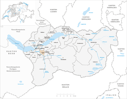
Gsteigwiler is a municipality in the Interlaken-Oberhasli administrative district in the canton of Bern in Switzerland.
Gsteigwiler belongs to the Small Agglomeration Interlaken with 23,300 inhabitants (2014).
Gsteigwiler is first mentioned in 1333 as Wiler.
The village first appears during the Middle Ages when it was owned by local nobles. In 1310 they donated the village to Interlaken Abbey. It remained in the hands of the Abbey until Bern accepted the Protestant Reformation and secularized the Abbey in 1528. Under Bernese rule it became part of the new bailiwick of Interlaken and remained part of the district of Interlaken until it was dissolved in 2009.
The village remained isolated until the Wilderswil station of the Bernese Oberland Railway was built in 1890. Two years later a rack railway was built from the village to Breitlauenen in the Schynige Platte mountains.
Today most of the population commutes to Interlaken for work, though there is some tourism in the village.
Gsteigwiler has an area of 7.02 km2 (2.71 sq mi). Of this area, 1.58 km2 (0.61 sq mi) or 22.5% is used for agricultural purposes, while 4.57 km2 (1.76 sq mi) or 65.1% is forested. Of the rest of the land, 0.31 km2 (0.12 sq mi) or 4.4% is settled (buildings or roads), 0.1 km2 (25 acres) or 1.4% is either rivers or lakes and 0.47 km2 (0.18 sq mi) or 6.7% is unproductive land.
Of the built up area, housing and buildings made up 2.3% and transportation infrastructure made up 2.0%. Out of the forested land, 59.0% of the total land area is heavily forested and 5.4% is covered with orchards or small clusters of trees. Of the agricultural land, 10.3% is pastures and 11.7% is used for alpine pastures. All the water in the municipality is flowing water. Of the unproductive areas, 2.4% is unproductive vegetation and 4.3% is too rocky for vegetation.
...
Wikipedia


