White Creek
| White Creek | |
|---|---|
| Town | |

church from the White Creek Historic District
|
|
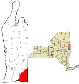
 Location in Washington County and the state of New York. |
|
| Coordinates: 43°0′35″N 73°20′38″W / 43.00972°N 73.34389°WCoordinates: 43°0′35″N 73°20′38″W / 43.00972°N 73.34389°W | |
| Country | United States |
| State | New York |
| County | Washington |
| Area | |
| • Total | 47.9 sq mi (124.1 km2) |
| • Land | 47.9 sq mi (124.0 km2) |
| • Water | 0.1 sq mi (0.2 km2) |
| Elevation | 1,283 ft (391 m) |
| Population (2000) | |
| • Total | 3,411 |
| • Density | 71.3/sq mi (27.5/km2) |
| Time zone | Eastern (EST) (UTC-5) |
| • Summer (DST) | EDT (UTC-4) |
| ZIP codes |
12057 (primary)
|
| Area code(s) | 518 |
| FIPS code | 36-81578 |
| GNIS feature ID | 0979635 |
White Creek is a town in Washington County, New York, United States. It is part of the Glens Falls Metropolitan Statistical Area. The town population was 3,411 at the 2000 census.
Settlement in the town of "White Creek began after the granting of the Cambridge Patent in 1761. The first settlers in the present hamlet of White Creek were Quakers. John Allen built the first permanent residence in 1757 with a later addition in 1770, a house which remains as one of the best-preserved structures surviving from the eighteenth century in White Creek. The Cornell House and the Christopher Allen House (both built 1772) also survive from the colonial period, reflecting a rich variety of house styles. According to local tradition, the Christopher Allen House was operated as a tavern, and its ballroom also served as a temporary hospital for wounded from the nearby Battle of Waloomsac [Bennington] in 1777.
White Creek became a center of regional commerce late in the eighteenth century, and local prosperity reached its high point during the 1840s. Among the most interesting and important of White Creek's historic buildings are its commercial structures. The hotel and tavern and the harness shop are outstanding, rare Greek Revival-style rural commercial buildings whose presence in the historic district contribute to a fuller understanding of life in White Creek during the nineteenth century. The businesses housed in these and other White Creek structures prospered, enabling owners to build comfortable homes along the streets of the hamlet. Most of these residences survive within the present district, and their stylistic treatment illustrates the relationship between wealth and taste in White Creek from the 1750s to the 1880s.
Present day White Creek is made up of mostly farms, fields, small residences, and forest land. There is one small community located on Route 68 and Niles Road that is a cluster of about 20-30 homes. These residences make up the White Creek National Historic District.
According to the United States Census Bureau, the town has a total area of 47.9 square miles (124 km2), of which, 47.9 square miles (124 km2) of it is land and 0.1 square miles (0.26 km2) of it (0.13%) is water.
The east town line is the state line of Vermont. The Hoosic River defines part of the south town line.
...
Wikipedia
