Westville, Indiana
| Westville, Indiana | |
|---|---|
| Town | |

Main Street in Westville
|
|
| Motto: Community of Progress | |
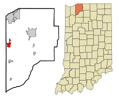
 Location of Westville in the state of Indiana |
|
| Coordinates: 41°32′45″N 86°54′15″W / 41.54583°N 86.90417°WCoordinates: 41°32′45″N 86°54′15″W / 41.54583°N 86.90417°W | |
| Country | United States |
| State | Indiana |
| County | LaPorte |
| Township | New Durham |
| Area | |
| • Total | 3.09 sq mi (8.00 km2) |
| • Land | 3.09 sq mi (8.00 km2) |
| • Water | 0 sq mi (0 km2) |
| Elevation | 794 ft (242 m) |
| Population (2010) | |
| • Total | 5,853 |
| • Estimate (2012) | 6,069 |
| • Density | 1,894.2/sq mi (731.4/km2) |
| Time zone | Central (CST) (UTC-6) |
| • Summer (DST) | CDT (UTC-5) |
| ZIP code | 46391 |
| Area code(s) | 219 |
| FIPS code | 18-83420 |
| GNIS feature ID | 0445865 |
| Website | http://www.westville.us |
Westville is a town in New Durham Township, LaPorte County, Indiana, United States. The population was 5,853 at the 2010 census. It is included in the Michigan City, Indiana-La Porte, Indiana Metropolitan Statistical Area. Westville is located in a part of Indiana referred to by locals as The Region.
Westville was platted in 1851, and incorporated as a town in 1864. It was a station and shipping point at the junction of two railroads.
The Everel S. Smith House was listed in the National Register of Historic Places in 1990.
According to the 2010 census, Westville has a total area of 3.09 square miles (8.00 km2), all land.
As of the census of 2010, there were 5,853 people, 1,093 households, and 705 families residing in the town. The population density was 1,894.2 inhabitants per square mile (731.4/km2). There were 1,186 housing units at an average density of 383.8 per square mile (148.2/km2). The racial makeup of the town was 72.1% White, 25.1% African American, 0.2% Native American, 0.3% Asian, 1.6% from other races, and 0.7% from two or more races. Hispanic or Latino of any race were 6.3% of the population.
...
Wikipedia
