Westphalia, Missouri
| Westphalia, Missouri | |
|---|---|
| City | |

Westphalia in 1993
|
|
| Nickname(s): "The Pearl of Osage County" | |
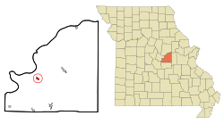
 Location of Westphalia, Missouri |
|
| Coordinates: 38°26′25″N 91°59′52″W / 38.44028°N 91.99778°WCoordinates: 38°26′25″N 91°59′52″W / 38.44028°N 91.99778°W | |
| Country | United States |
| State | Missouri |
| County | Osage |
| Area | |
| • Total | 0.53 sq mi (1.37 km2) |
| • Land | 0.53 sq mi (1.37 km2) |
| • Water | 0 sq mi (0 km2) |
| Elevation | 610 ft (186 m) |
| Population (2010) | |
| • Total | 389 |
| • Estimate (2012) | 390 |
| • Density | 734.0/sq mi (283.4/km2) |
| Time zone | Central (CST) (UTC-6) |
| • Summer (DST) | CDT (UTC-5) |
| ZIP code | 65085 |
| Area code(s) | 573 |
| FIPS code | 29-78910 |
| GNIS feature ID | 0729411 |
Westphalia is a city in Osage County, Missouri, United States. The population was 389 at the 2010 census. It is part of the Jefferson City, Missouri Metropolitan Statistical Area.
Westphalia is heavily influenced by the German heritage of the majority of its inhabitants. Many of the early settlers of the area came from the Westphalia region of Germany, hence the name. Many buildings are influenced by nineteenth-century German architecture, and streets are labeled in both English and German. The center of population of Missouri is located in Westphalia.
Westphalia was platted in 1835, and named after Westphalia, in Germany, the native home of a large share of the first settlers. A post office called Westphalia has been in operation since 1848.
St. Joseph Church was listed on the National Register of Historic Places in 1972.
Westphalia is located at 38°26′25″N 91°59′52″W / 38.44028°N 91.99778°W (38.440207, -91.997887).
According to the United States Census Bureau, the city has a total area of 0.53 square miles (1.37 km2), all of it land.
...
Wikipedia
